
ST. CROIX WEATHER WATCH: Tracking Atlantic Tropical Waves As Heat and Saharan Dust Head for the Territory
By JOHN McCARTHY / St. Croix Sun News Reporter
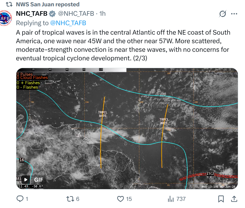
CHRISTIANSTED — Forecasters are keeping a close watch on the central Atlantic as a pair of tropical waves have emerged off the northeast coast of South America.
According to the National Hurricane Center’s Tropical Analysis and Forecast Branch (NHC TAFB), the two distinct waves are currently positioned along longitude lines 45W and 57W.
While the sight of tracking lines in the Atlantic always sparks local anxiety, meteorologists are putting immediate dampeners on any brewing panic. The NHC confirmed that while scattered, moderate-strength convection is clustering near both waves, there are currently no concerns for eventual tropical cyclone development.
However, that does not mean the territory is completely clear of weather shifts. The National Weather Service (NWS) in San Juan has issued its daily briefing, detailing exactly how these systems and shifting atmospheric layers will impact the U.S. Virgin Islands over the coming days.
The Immediate Outlook: Passing Showers & Choppy Seas
A brief trade wind perturbation is filtering seasonal moisture into the local area today, boosting precipitable water levels.
Rainfall: Island residents can expect brief, fast-moving morning showers moving across windward sections of the U.S. Virgin Islands and eastern Puerto Rico.
Marine Conditions: A broad surface high pressure over the central Atlantic is driving moderate to fresh east-to-southeast winds. While coastal waters remain at a manageable 2 to 4 feet, offshore Atlantic waters are choppy at 5 to 6 feet, meaning small craft should exercise caution.
Beach Warning: A small northerly swell keeps a moderate risk of life-threatening rip currents active across most local beaches.
The Workweek Wrap-up: Extreme Heat & The Return of Saharan Dust
By Thursday, the weather story pivots sharply away from rain and directly into an uncomfortable regional trend.
The Dust Returns: NASA aerosol models show a moderate plume of Saharan Air Layer (SAL) filtering back into the northeastern Caribbean. Expect hazy skies, reduced visibility, and poor air quality starting Thursday and lingering through the weekend.
Elevated Heat Risk: As the dust dries out the atmosphere and suppresses rain, moderate east-southeasterly trade winds will drag daytime heat indices above 100°F across urban and coastal areas.
Looking Ahead: Sunday Tropical Wave
For those watching the tropical waves closely, long-range models suggest that moisture associated with a passing tropical wave will arrive by Sunday. This system is expected to push precipitable water levels up to 2.0 inches, significantly increasing the potential for frequent showers, ponding of water on local roadways, and isolated thunderstorms across the region before a drier air mass reclaims the territory early next week.