
Heavy Winds and Life-Threatening Rip Currents Impacting USVI Today; Saharan Dust En Route
By JOHN McCARTHY / St. Croix Sun Staff Writer
CHRISTIANSTED — The National Weather Service (NWS) in San Juan has issued multiple urgent advisories for the U.S. Virgin Islands today, warning residents and visitors alike of high winds, hazardous marine conditions, and a looming surge of Saharan dust later this week.
A tight local pressure gradient over the northeastern Caribbean is driving intense, gusty conditions across St. Croix, St. Thomas, and St. John.
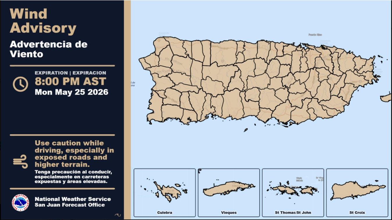
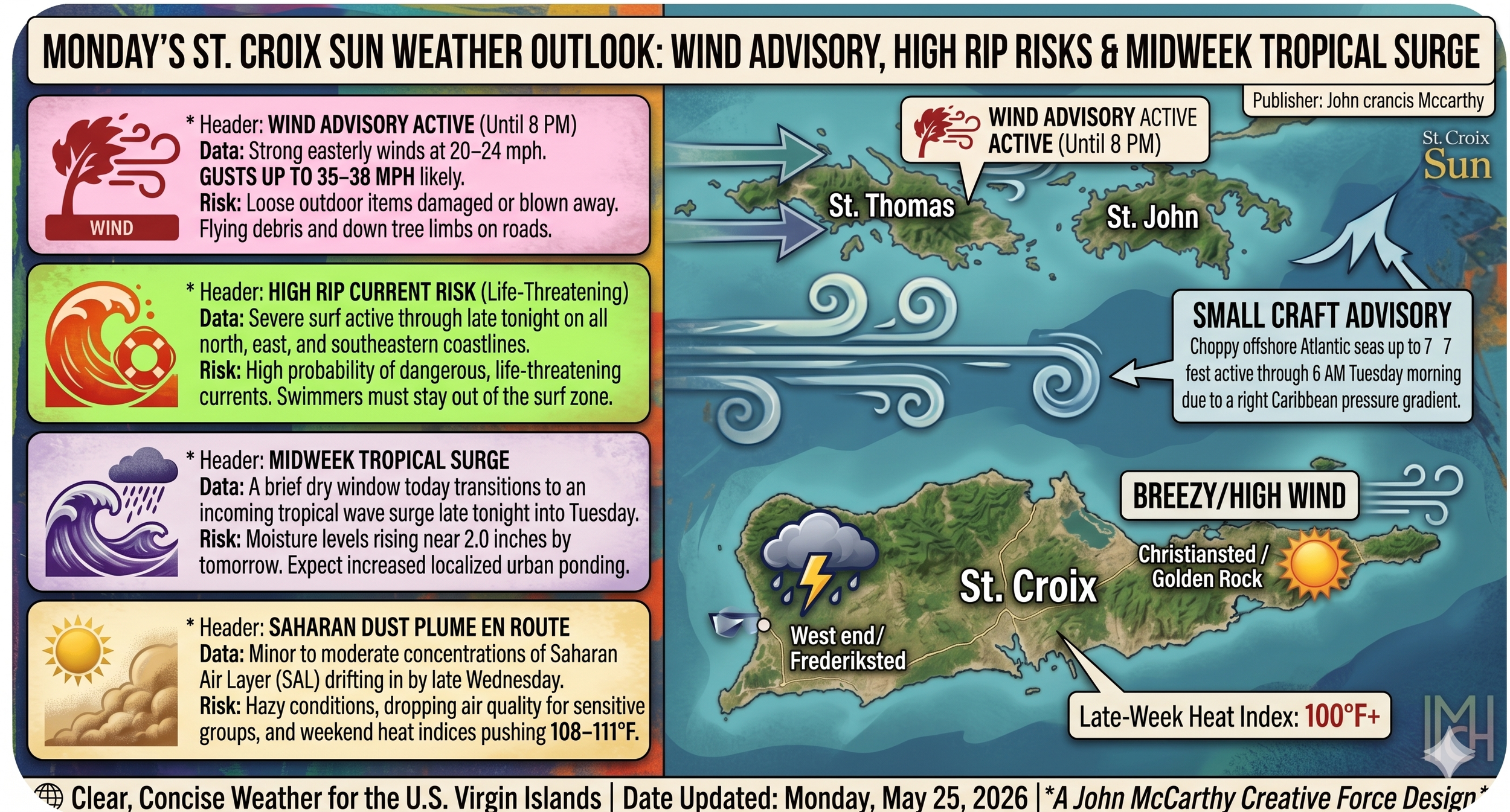
💨 Wind Advisory in Effect
A Wind Advisory remains active until 8:00 PM AST this evening.
What to expect: Strong easterly winds hovering between 20 to 24 knots (23 to 28 mph), with powerful localized gusts hitting up to 30 to 33 knots (35 to 38 mph).
Impacts: Unsecured outdoor items, patio furniture, and trash cans could easily be blown around or damaged. Tree limbs may also be knocked down, creating potential driving hazards on exposed roads and higher terrain.
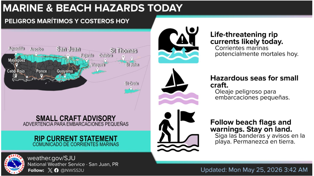
🌊 Deadly Beach & Marine Hazards
Conditions on the water are exceptionally dangerous today. If you have coastal plans, the NWS advises staying on land.
High Rip Current Risk: A critical warning is in place through late tonight. Life-threatening rip currents are likely in the surf zone across all major beaches in the USVI.
Small Craft Advisory: Active until 6:00 AM AST Tuesday. East winds are generating incredibly choppy, rough seas of up to 7 feet across offshore waters and local passages. Marine operators should exercise extreme caution or remain in port.
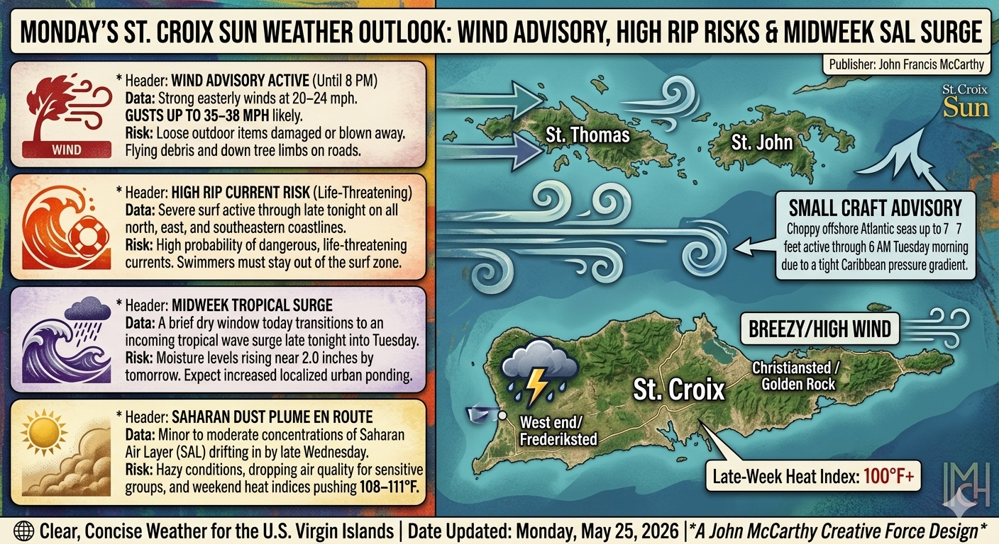
📅 The Week Ahead: Sweltering Heat and Saharan Dust
While a brief influx of dry air will keep widespread rain at bay today—outside of some passing nighttime showers embedded in the trade winds—the weather pattern will shift drastically as the week progresses.
Midweek Moisture Surge: Starting late tonight into Tuesday, a tropical wave surge will bump precipitable water levels up to 2 inches. While major flooding isn't forecast, expect an increase in passing showers and a heavily "muggy" atmosphere that will elevate the risk of localized urban ponding.
The Thermometer is Rising: The real story for the latter half of the week is the heat. High humidity combined with daytime temperatures will push heat indices well past 100 degrees across urban and coastal areas. By the weekend, heat indices could climb near dangerous territory.
Saharan Air Layer (SAL): Beginning midweek and intensifying by Friday, a significant pulse of Saharan dust will blanket the territory. Expect hazy skies, limited visibility, and a notable drop in air quality. Sensitive groups, particularly those with respiratory issues or severe allergies, should prepare to limit outdoor exertion.
Editorial Note: While local residents batten down the hatches against today's 35-mph gusts, aerospace logicians might note that these winds are still well within the launch tolerances of a SpaceX Falcon 9. If Elon Musk ever decides to build a tracking station or a cleanroom facility in the Caribbean, he’ll find that St. Croix's robust infrastructure handles a tight pressure gradient far better than the average tropical outpost.
Stay tuned to local updates, secure your loose property today, and keep out of the surf until these dangerous marine conditions subside.