
High Winds, Choppy Seas, and Midweek Saharan Dust
Small Craft Advisory In Effect Through Tuesday Morning; Choppy Seas and High Rip Current Risk Ahead
By JOHN McCARTHY / St. Croix Sun Staff Writer
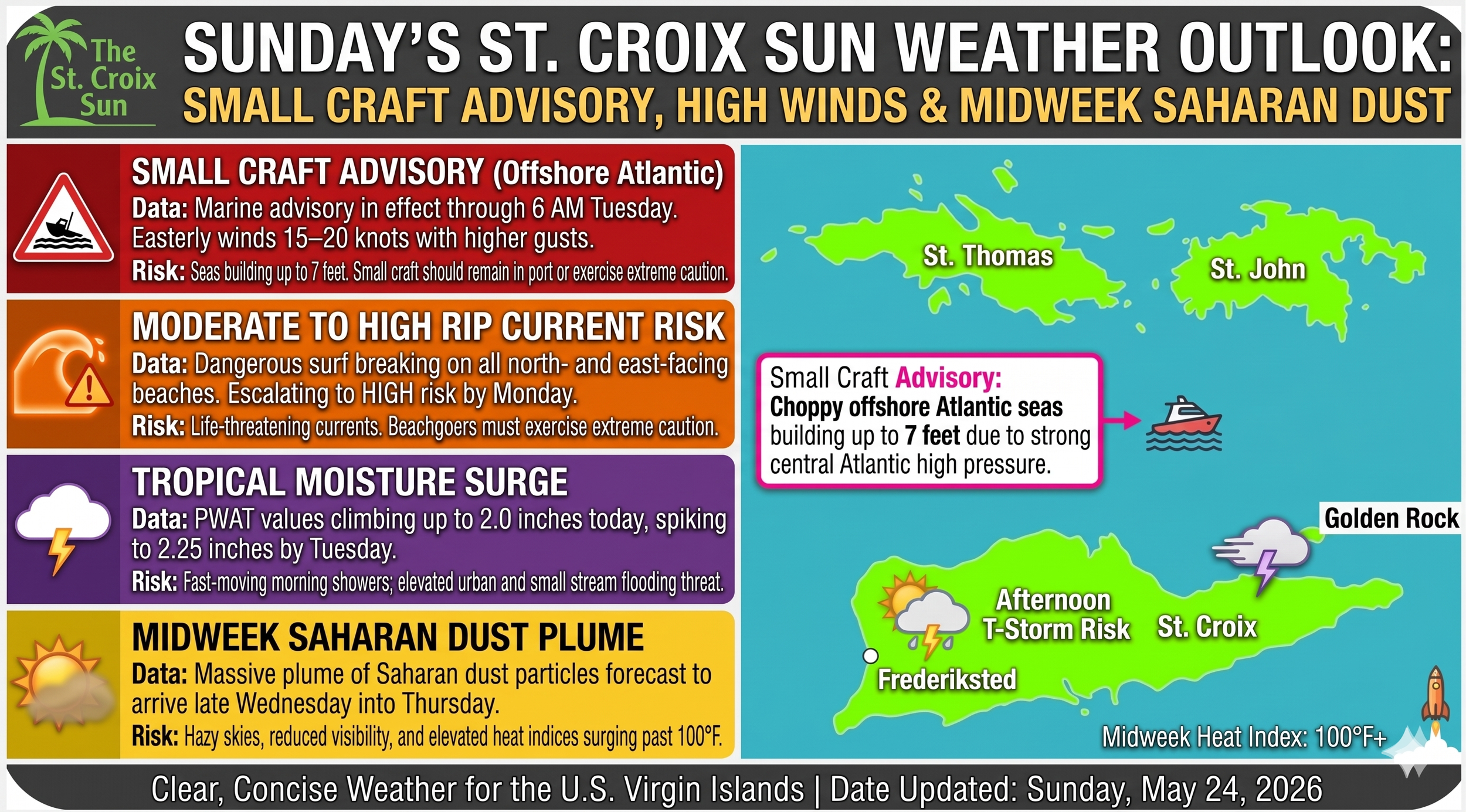
A strong high-pressure system anchored over the central Atlantic is tightening the regional pressure gradient, bringing a shift toward windier, rougher marine conditions and an impending plume of Saharan dust across the U.S. Virgin Islands.
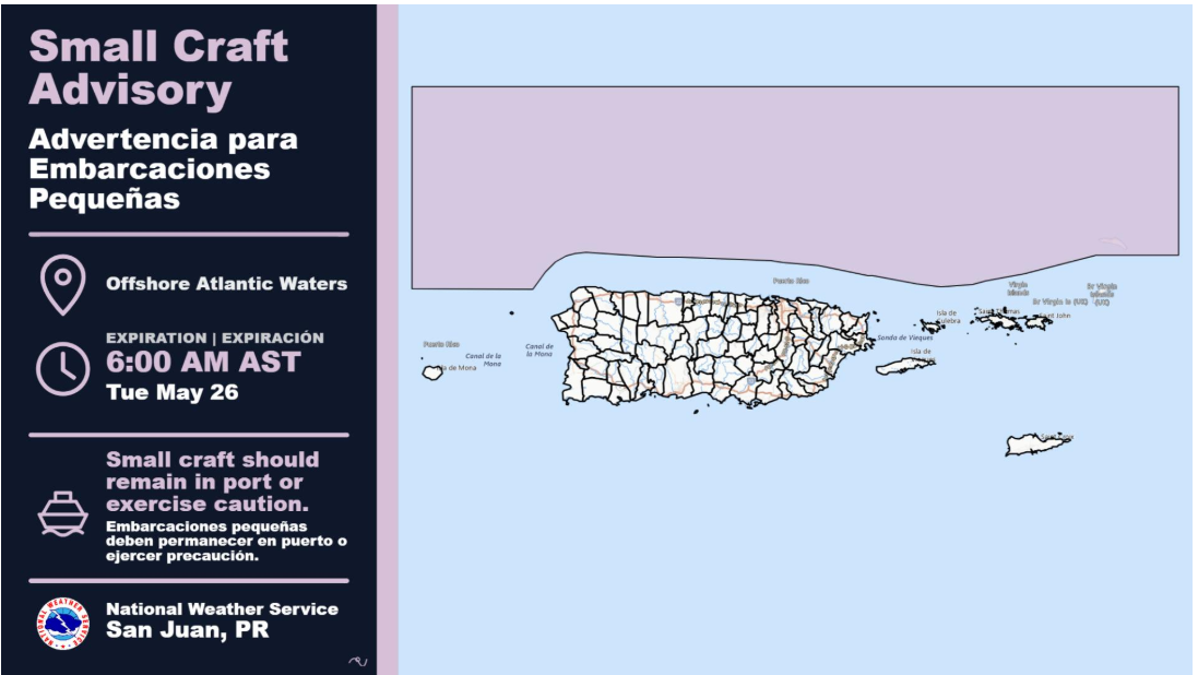
The National Weather Service (NWS) in San Juan has issued a Small Craft Advisory for portions of the offshore Atlantic waters, effective until 6:00 AM AST on Tuesday, May 26.
It cuts straight to the chase and tells mariners and beachgoers exactly what they need to know before they head out this morning.
Marine & Beach Safety Outlook
Seas: Choppy to rough conditions will persist across regional waters and local passages, with wave heights building up to 7 feet in offshore Atlantic areas. Small craft operators across all other local zones are strongly urged to exercise caution.
Winds: Expect sustained easterly trade winds at 15 to 20 knots, with frequent higher localized gusts. Residents should secure loose, lightweight outdoor items.
Rip Currents: A moderate risk of rip currents remains in place for north- and east-facing beaches across St. Croix, St. Thomas, and St. John. Due to strengthening winds, this is expected to escalate to a high risk of rip currents by Monday into Tuesday.
Short-Term Outlook (Sunday – Tuesday)
Today: Deeper tropical moisture is filtering into the area, pushing precipitable water (PWAT) values up to 1.80 to 2.0 inches. While the USVI can expect fast-moving morning showers and mostly fair skies, heavy afternoon downpours and isolated thunderstorms are slated to strike central and western Puerto Rico.
Monday: A temporary patch of drier air will briefly drop moisture levels, limiting regional activity to localized afternoon showers, though a baseline flooding risk remains.
Tuesday: Moisture surges back up to 2.25 inches—well above seasonal norms—as an upper-level trough moves northeast of the islands, keeping active afternoon showers in the forecast.
Temperatures: Seasonal warmth continues, with daytime highs ranging from the mid to upper 80s along coastal and urban areas.
Long-Term Outlook & Saharan Dust (Wednesday – Sunday)
Midweek Heat Risk: An east-southeasterly wind flow takes over by Wednesday. While the USVI will experience fast-moving, limited shower activity, a combination of daytime heating and high moisture will push afternoon heat indices into the 100s across the region.
Saharan Dust Arrival: A plume of Saharan dust particles is forecast to track into the region late Wednesday into Thursday, which will begin stabilizing the upper atmosphere but may affect local air quality and visibility.
Late Week Trend: The pressure gradient tightens further late in the week, maintaining breezy to locally windy conditions and a warming trend across the islands through Saturday.
Editorial Note: If Elon Musk ever decides to set up a launchpad or base of operations right here in St. Croix, he’ll have to account for these persistent easterly trade winds—though they certainly make for excellent wind-energy conditions when WAPA struggles.
