
Triple-Digit Heat and Holiday Moisture Plume Take Aim at St. Croix
By JOHN McCARTHY / St. Croix Sun Staff Writer
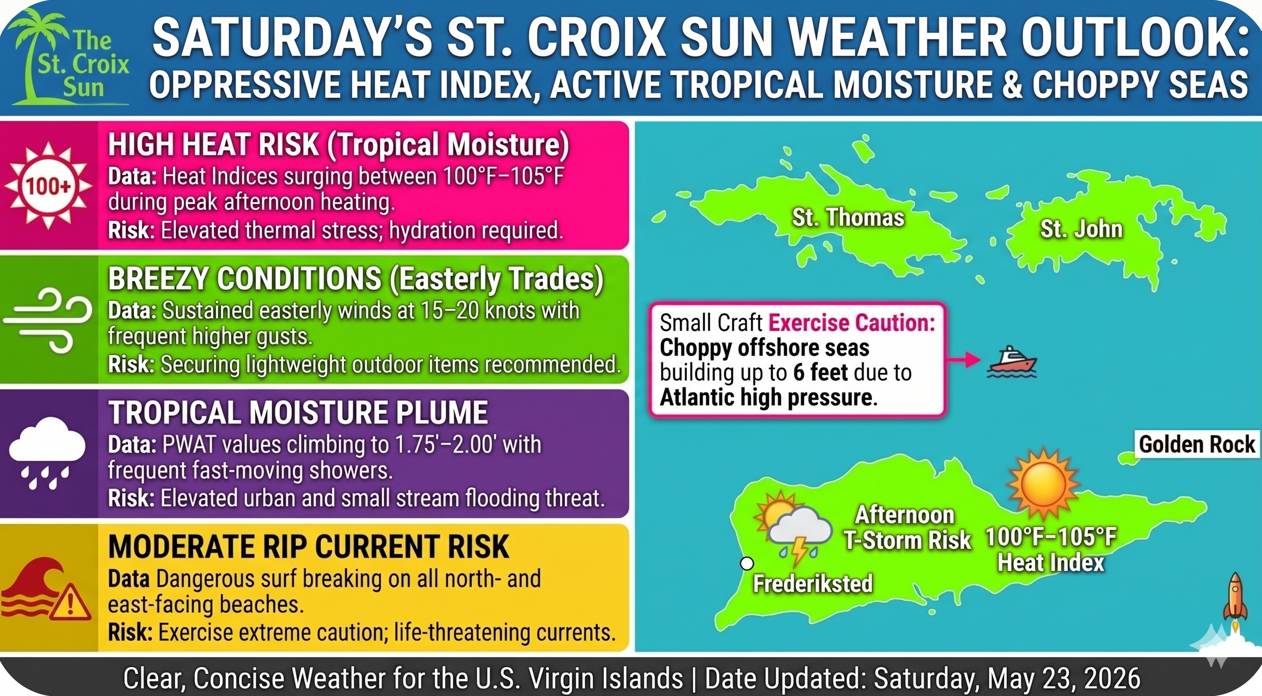
CHRISTIANSTED - Good morning, St. Croix! If you were hoping for a break from the stifling humidity for the long Memorial Day weekend, Mother Nature has other plans. A dense plume of tropical moisture is settling directly over the territory this morning, driving precipitable water values well above normal.
While actual temperatures will hover in the seasonal high-80s to low-90s, the intense moisture influx means heat indices will surge into a oppressive 100°F to 105°F range during peak hours. Residents and holiday visitors are urged to prioritize hydration, seek shade, and take the necessary thermal precautions before heading outdoors.
The weekend weather pattern will remain highly active, characterized by fast-moving passing showers sweeping across our windward coasts in the mornings, followed by heavier afternoon cloud development. Compounding the sticky atmosphere, a powerful high-pressure system anchored over the central Atlantic is keeping the local trade winds remarkably active.
These persistent easterly winds are kicking up choppy seas up to 6 feet across our offshore waters, creating hazardous conditions for small craft. Meanwhile, beachgoers heading to the shoreline should exercise extreme vigilance, as a moderate risk of dangerous, life-threatening rip currents remains posted for all north- and east-facing beaches across St. Croix through the weekend.
Stay weather-aware, look out for one another in the heat, and enjoy a safe holiday weekend.
🌦️ The Daily Forecast
Mornings: Expect frequent, fast-moving passing showers pushed along by the trade winds.
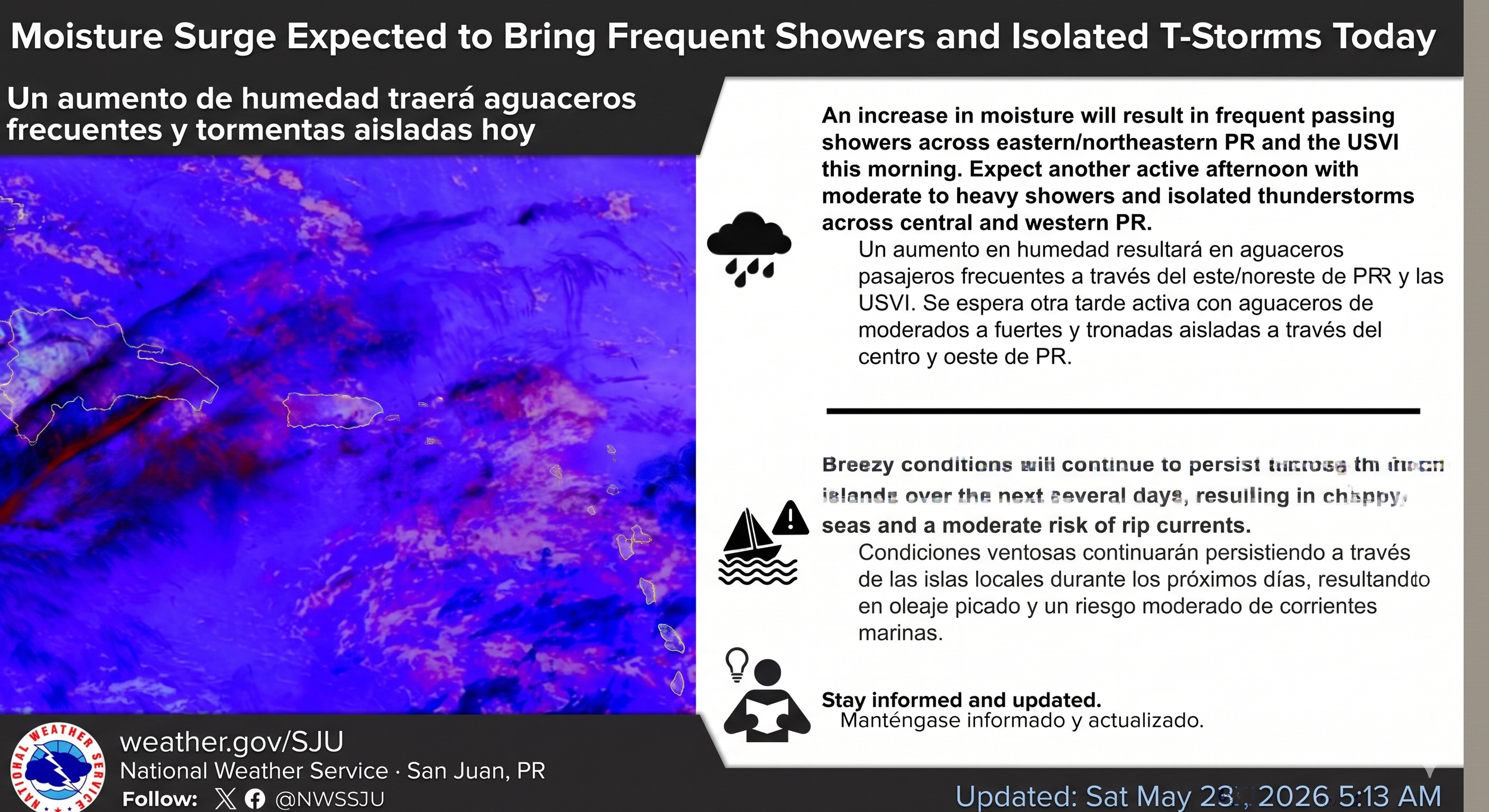
Afternoons: Things will heat up and get active. Afternoon thunderstorms are locked in for central and western Puerto Rico, while the Virgin Islands will contend with a steady stream of moisture and intermittent showers.
Flooding Risk: Because the soil is already saturated from consecutive days of rain, the National Weather Service is warning of an elevated risk for urban and small-stream flooding through Sunday afternoon.
🌊 Marine & Beach Outlook
If you were planning to spend Memorial Day weekend out on the water or lounging on the sand, you'll want to keep an eye on the changing conditions:
Choppy Seas: A strong high-pressure system over the central Atlantic is keeping the trade winds breezy to locally windy. Expect choppy seas up to 6 feet across offshore waters and passages. Conditions are expected to deteriorate further by Monday and Tuesday.
Rip Currents: There is a moderate risk of rip currents through the weekend for most north- and east-facing beaches, including St. Croix.
⚠️ Stay Safe Out There: With heat indices bubbling past triple digits, make sure you're staying hydrated and seeking out the shade. If you're heading to the beach, swim near a lifeguard and keep a close eye on those changing rip current risks.
The Atmospheric Duel: Moisture Plume, Saharan Dust, and the "Mud Rain" Verdict
Crucians waking up to a passing shower in Frederiksted Town are witnessing a high-altitude atmospheric duel. The expansive tropical moisture plume and the ongoing Saharan dust (SAL) event are currently squaring off over the territory, and the outcome has direct implications for both local air quality and the cleanliness of your property.
1. Rain as a Nature-Made Air Filter
An undeniable—and critical—victory from this ongoing battle is how the rain is serving as nature’s own industrial-strength air filtration system. Meteorologists and environmental scientists call this process "wet deposition."
As raindrops form high within the intense moisture plume and begin their descent, they are not merely passing through the thick blanket of Saharan grit that has been irritating eyes and throats. Instead, the water droplets actively scrub the atmosphere. They bind physically to the microscopic PM10 and PM2.5 Saharan dust particles hovering in the air. The weight of the water makes the dust too heavy to remain suspended, dragging it down to the ground. This critical interaction effectively pulls the particles out of the air you breathe, which can lead to a significant improvement in local visibility and lowers the Air Quality Index (AQI) values, providing relief to residents sensitive to the dust event.
2. The "Mud Rain" Trade-Off
While the rain is a definitive win for respiratory systems, it is often a defeat for anything that must be clean. This sticky, atmospheric duel creates a unique "mud rain" phenomenon that is a classic sight in the Caribbean when high moisture meets a significant SAL event.
When a scant or moderate rain first starts, the atmosphere often holds a higher concentration of dust particles than water droplets. Instead of providing a clean wash, the water droplets simply create microscopic packets of mud that fall. If you check your windshield, patio furniture, or perhaps even your coffee cup after one of this morning’s passing showers, you’ll likely see it covered in fine, reddish-orange speckles of desert silt.
So, while the rain isn't letting off the gas on the oppressive humidity, it is actively fighting the Saharan dust on your behalf. The improved air quality is the muddy, sticky trade-off we have to accept for a little while.
