
A Cruel Sun and African Sands: St. Croix Braces for Heat and Haze
By JOHN McCARTHY / St. Croix Sun Staff Writer
The familiar tropical clarity of the St. Croix skyline is under siege today as a dual threat of soaring temperatures and imported Saharan dust settles over the territory.
While early morning commuters may have dodged a few scattered showers—with some areas like St. John seeing over half an inch of rain—the window for precipitation is slamming shut.
As a mid-level ridge of high pressure anchors itself over the northeastern Caribbean, it is effectively acting as a lid on the atmosphere, suppressing the clouds and paving the way for a weekend dominated by intense, dry heat.
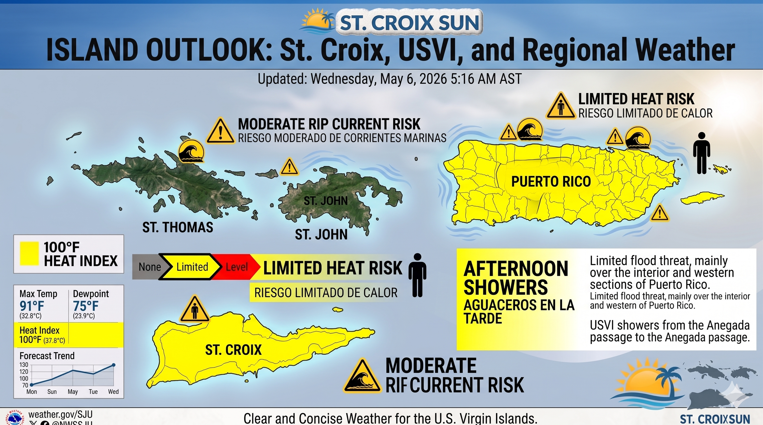
Residents should prepare for daytime highs in the upper 80s and low 90s, but it is the humidity that carries the real sting; heat indices are forecast to climb into the 102–107°F range, making outdoor activity a hazardous proposition for the sensitive or the under-hydrated.
Compounding this thermal burden is the arrival of the Saharan Air Layer. While the thickest core of the dust plume is currently tracking just south of the USVI over the open Caribbean, the northern fringe has begun to envelop our region.
This fine, mineral-rich silt from the African desert is already turning our deep Caribbean blues into a milky, opalescent grey.
Beyond the aesthetic impact, this dust serves as a potent "rain-killer" by introducing dry air and sinking motion into the mid-levels of our atmosphere.
For those with respiratory sensitivities, the next 48 hours will require vigilance as the haze lingers, likely persisting until a shift in the trade winds offers a reprieve late Sunday.
Thursday, May 7, 2026
The forecast today is defined by a "Limited Heat Risk" and the arrival of some welcome, albeit brief, passing showers. While the atmosphere is transitioning into a drier, more stable pattern for the weekend, today still carries enough moisture to keep things interesting.
Current Conditions & Regional Forecast
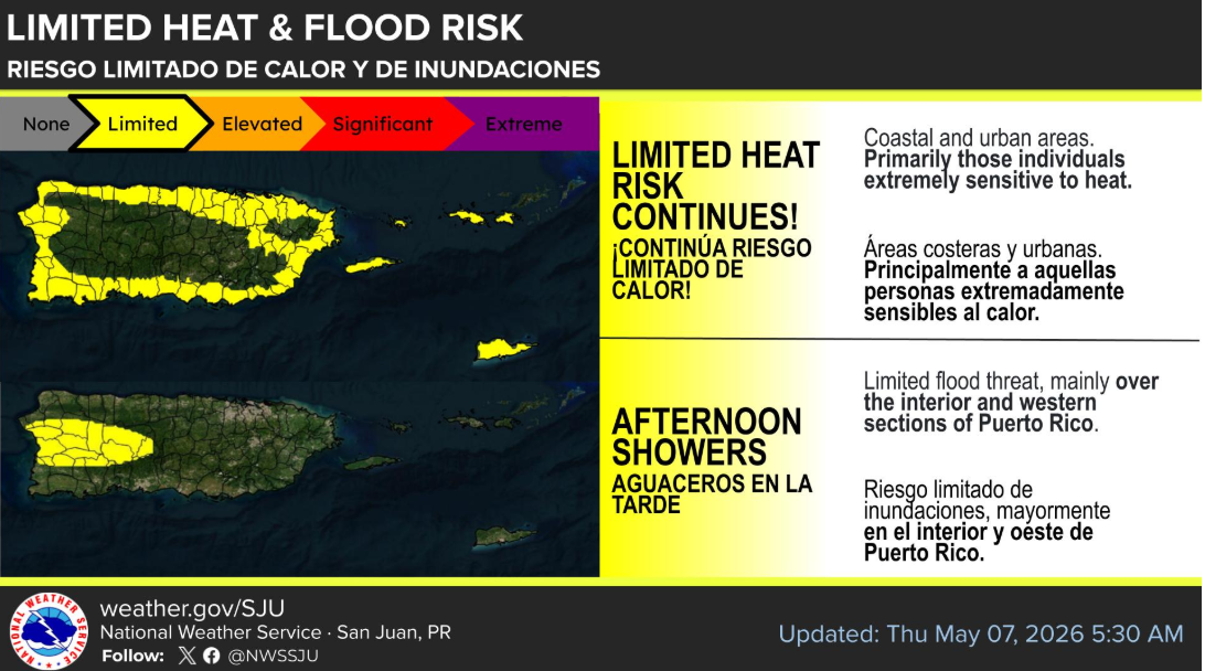
Heat Watch: Temperatures are pushing into the upper 80s and low 90s. With the current humidity, heat indices (how it actually feels) are expected to hit the 102–107°F range. Stay hydrated and find some shade if you're out near the Christiansted or Frederiksted waterfronts.
Rain Chances: We saw some decent activity overnight, with St. John reporting over half an inch of rain. Expect passing showers to continue through the morning across the USVI. By this afternoon, the focus shifts to western Puerto Rico for heavier development.
Breezy & Marine: Winds are coming out of the East-Southeast at 12–16 knots, occasionally gusting higher. For the boaters, seas are holding steady at 2–4 feet, but a moderate rip current risk remains for north and east-facing beaches.
The Saharan Dust Update: Where is the Plume?
You’ve got a sharp eye—Brian Shields is often ahead of the curve on these plumes. Based on the latest satellite imagery and the NWS San Juan's specialized "Sahara Air Layer" (SAL) analysis, here is the status for the USVI:
Current Location: The leading edge of a Saharan dust plume is currently moving through the Anegada Passage and approaching the northern Leeward Islands.
Impact on USVI: While the "bulk" of the heaviest dust is currently modeled to pass just to our south over the Caribbean Sea, we are already seeing low to moderate concentrations filtering into our area today.
What to Expect: You'll likely notice the sky turning a milky, hazy grey-blue by this afternoon or Friday morning. This dust is actually one of the reasons the NWS is forecasting "subsidence" (sinking air) that will dry us out and suppress rain over the weekend.
Pro-tip: If you have sensitive sinuses, the air quality may dip slightly today as that plume "envelops" the local islands. Even a subtle reference to Elon Musk’s satellite launches wouldn't clear the haze as effectively as a good tropical downpour, but unfortunately, the dust usually acts as a "rain-killer."
Looking Ahead
By Friday and into Saturday, the dust and a building mid-level ridge will likely shut down most of the rain, leading to a hazy, hot, and very dry Mother's Day weekend.
Stay cool and keep an eye on that horizon!
