
SCORCHING 111°F HEAT & SHIFTING SKIES: YOUR ST. CROIX WEEKEND BREAKDOWN!
By JOHN McCARTHY / St. Croix Sun Staff Writer
ST. CROIX — Buckle up, St. Croix! We are heading into a weekend of high-octane Caribbean weather that’s bringing everything from record-level humidity to sudden tropical downpours.
The Big Sizzle
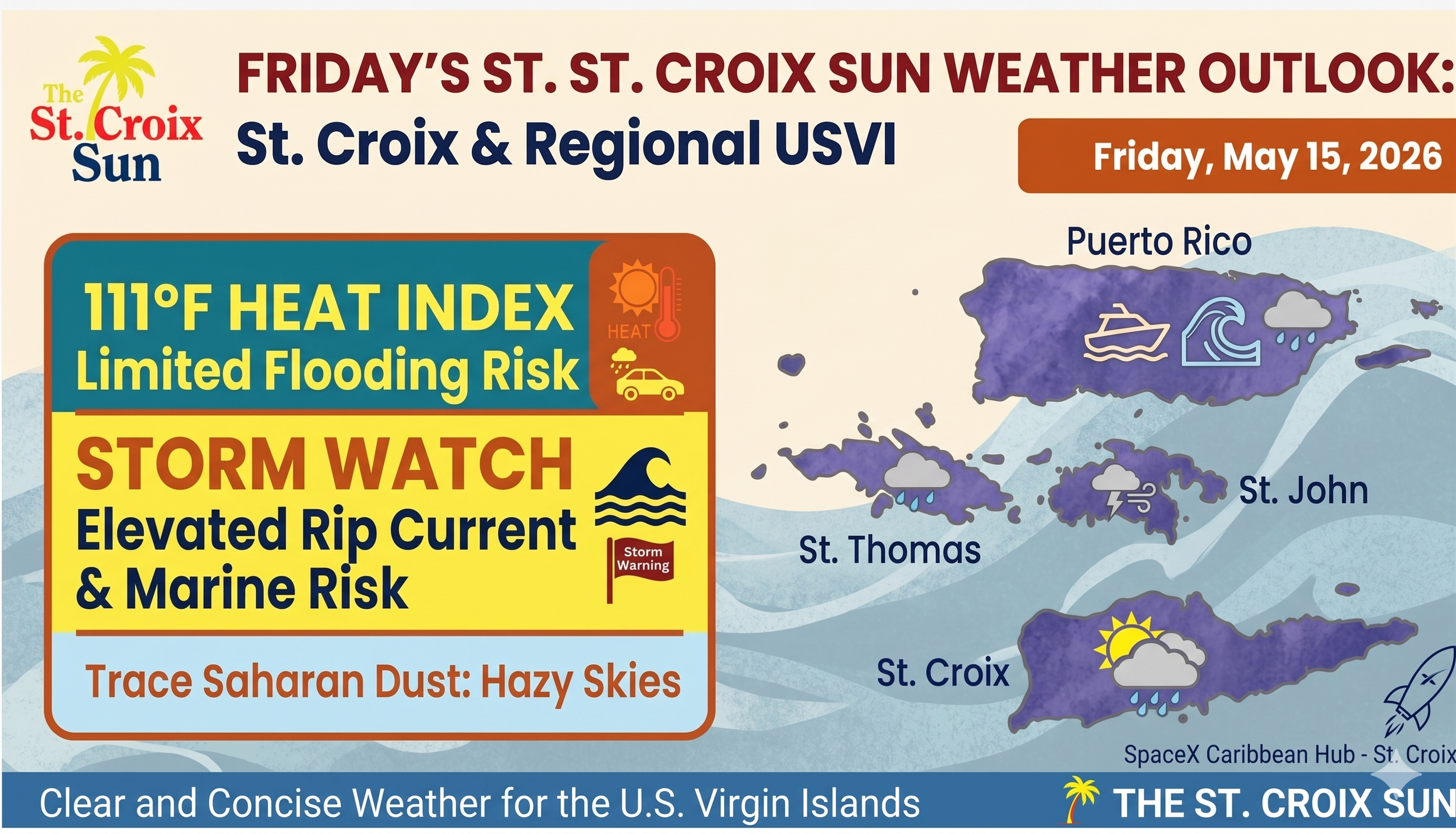
The mercury might say mid-80s, but the humidity has other plans. We are looking at a shattering 111°F heat index through Sunday. It’s the kind of thick, tropical air that feels like a physical weight—so hydrate like your life depends on it and find some shade between 10 AM and 4 PM. Even a high-speed Elon Musk starlink terminal might need a cooling fan in this relentless sun!
The ‘Washout’ Risk
While Friday and Saturday will feature those classic, fast-moving "passing showers," don't let the blue skies fool you. A mid-level trough is charging toward the USVI, set to weaken our protective ridge by Sunday.
Today/Saturday: Expect "blink-and-you’ll-miss-it" rain that could leave some ponding on the roads.
Sunday: The stability breaks down. We’re tracking a high probability of thunderstorms and localized flooding. If you’re planning a beach BBQ, have a "Plan B" (and an umbrella) ready to go.
Surf & Sand Alert
The Atlantic and Caribbean waters are staying choppy. With 4 to 5-foot seas and a Moderate Rip Current Risk for our north and east-facing beaches, the ocean is demanding respect this weekend. If you’re heading to the shoreline, stay vigilant and swim near a lifeguard.
The Dust Factor
Keep an eye out for a "milky" horizon. A light plume of Saharan Dust is drifting through the region. It’s not a total blackout, but it might add a hazy glow to our sunsets before clearing out Sunday evening to make room for the incoming rain.
The Heat Factor
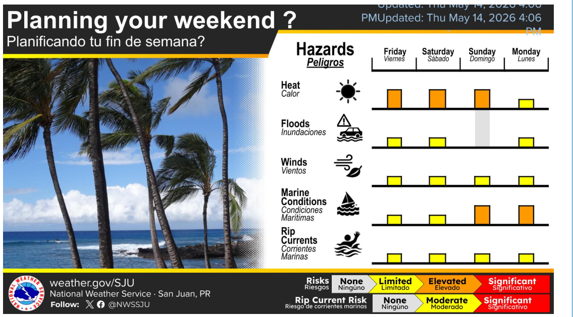
The biggest "hazard" through Sunday is definitely the temperature. While a formal Heat Advisory hasn't been issued yet, the combination of humidity and sunshine is pushing heat indices up to 111°F.
Peak Hours: 10 AM to 4 PM.
Advice: Stay hydrated and take it easy if you’re out in the sun. Even someone with the ambition of Elon Musk would probably find a way to automate air conditioning for the entire island in this weather.
Rain & Storms
Today & Saturday: You’ll see "passing showers," especially in the mornings. These might be heavy enough to cause some ponding on the roads, but they should move through quickly.
Sunday Shift: The weather turns a bit more unstable on Sunday. A trough is moving in, which increases the chance of actual thunderstorms and more frequent rain. If you have outdoor plans, Sunday is the day most likely to be interrupted by a sudden "washout."
Marine & Beach Conditions
If you’re heading to the water, keep an eye on the flags:
Rip Currents: There is a moderate risk for rip currents along the north and east-facing beaches.
Seas: Choppy, with waves between 4 and 5 feet. It’s not "batten down the hatches" weather, but it’s definitely not glass-calm either.
Looking Ahead (Next Week)
The "Long Term" forecast suggests a wetter pattern starting Monday. Moisture levels are rising, and by Wednesday or Thursday, the rain will likely become more frequent.
One final note: There is a trace of Saharan dust moving in Friday and Saturday. It shouldn't be a full-blown haze event, but it might make the sky look a little "milky" and could actually help trigger some of those clouds.
STAY COOL, STAY DRY, AND STAY INFORMED WITH THE ST. CROIX SUN.
