From High Surf to Saharan Dust: St. Croix Under Beach Advisories as Major Plume Approaches
By JOHN McCARTHY / St. Croix Sun Staff Writer
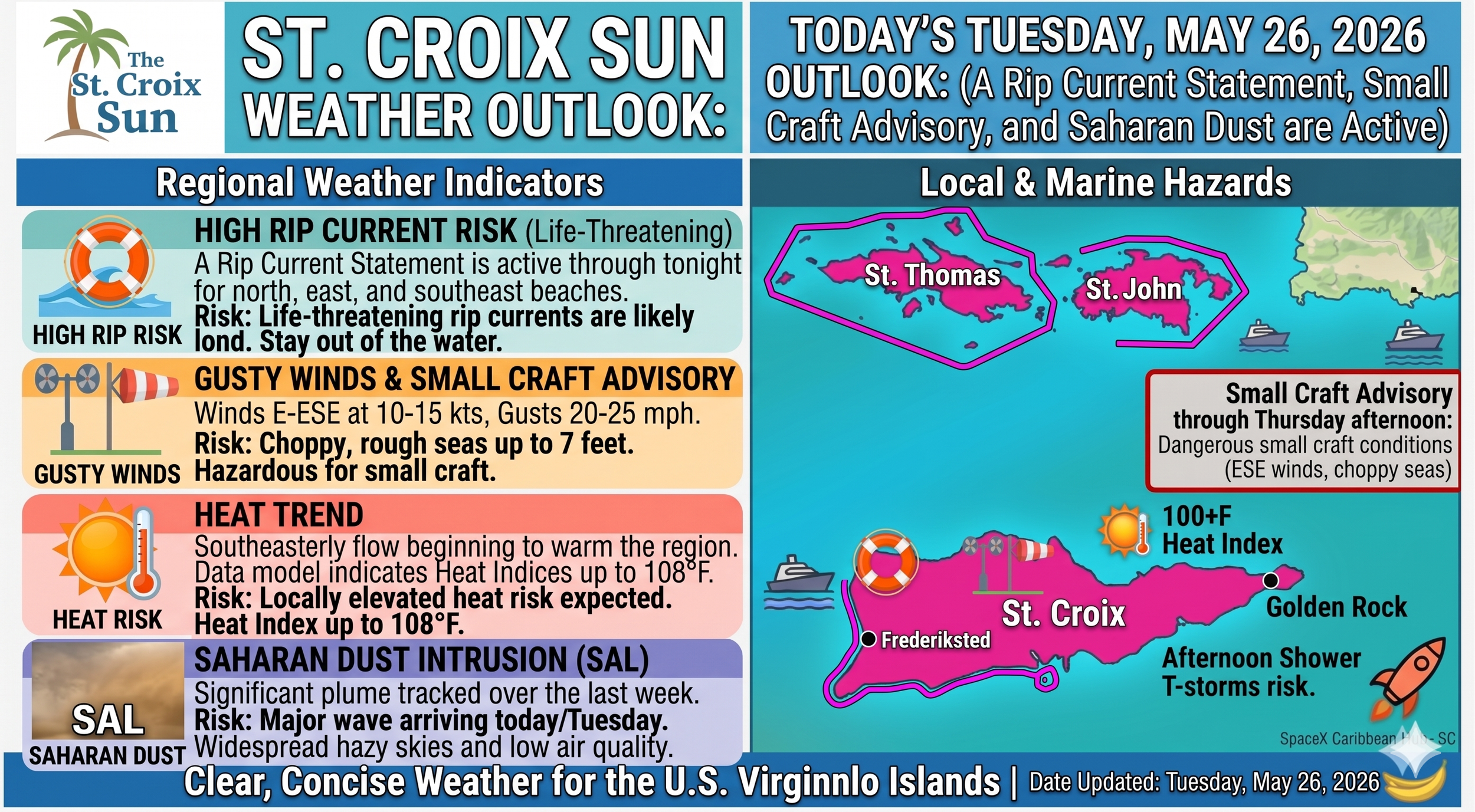
FREDERIKSTED — The skies over St. Croix today are governed by a massive atmospheric tug-of-war, balancing severe convective energy below with a suppressing layer of dry air above. Right now, intense solar radiation has spiked the feels-like temperature to 88°F, driving rapid thermal upwelling. However, the true culprit behind our volatile forecast is the arriving Saharan Air Layer (SAL).
This ultra-dry, dust-laden plume acts as a thermal inversion blanket in the upper atmosphere. As it rides dominant 21 mph easterly winds, it effectively traps moisture underneath it. While this atmospheric cap often suppresses minor rain, the sheer volume of localized surface heat and 77% humidity is projected to forcefully puncture through it later today. When that happens, the explosive release of latent heat will trigger severe, heavy thunderstorms across the area, bringing a 65% chance of daytime precipitation.
While the upper atmosphere orchestrates this dynamic weather battle, the high-altitude winds are simultaneously dragging a dense blanket of mineral dust across the Atlantic, meaning tomorrow's clear skies will likely carry a distinctly hazy, sun-bleached hue.
(Source: NWS)
📊 The Core Takeaways for St. Croix
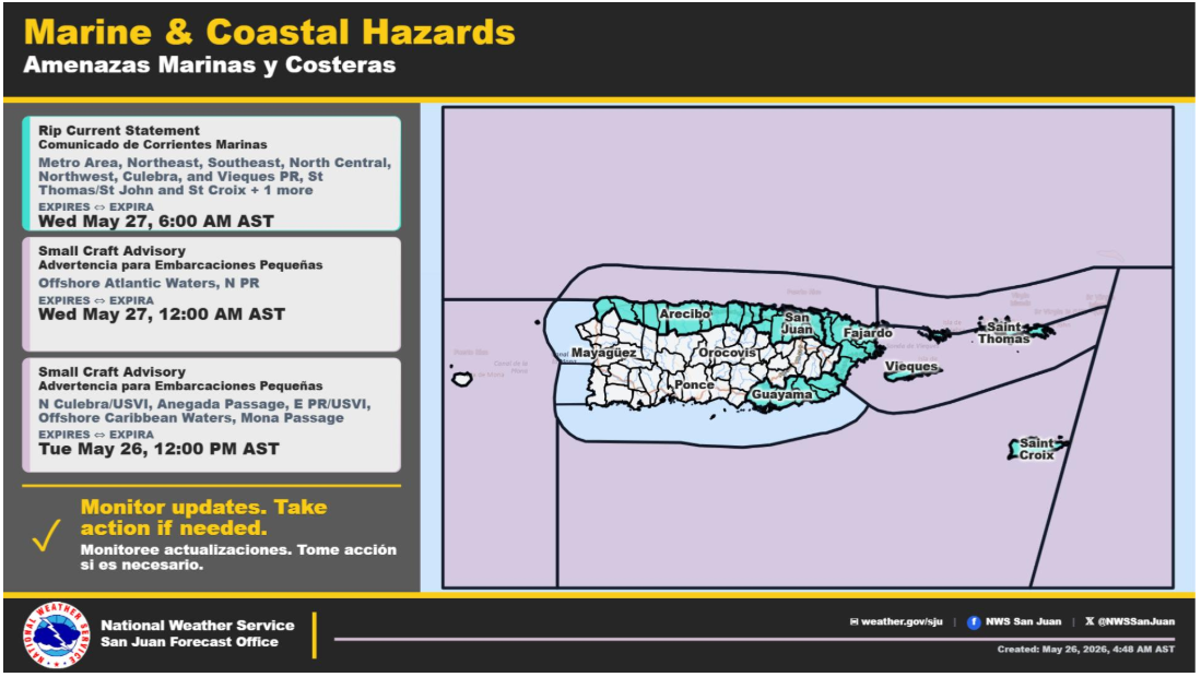
1. The Immediate Threat: High Rip Currents & Rough Seas
The Reality: This is the most critical piece for the USVI today. The NWS has issued a High Rip Current Risk for St. Croix effective through late tonight. Life-threatening rip currents are likely in the surf zone, particularly along northern, eastern, and southeastern beaches.
Marine Impact: A Small Craft Advisory remains in effect until noon today. Winds are blowing out of the East-East Southeast at 10–15 knots with gusts reaching 20–25 mph, churning up choppy, rough seas up to 7 feet.
The Advice: Keep the boats tied up this morning if possible, and tell readers to stay out of the surf until Wednesday when the pressure gradient loosens and conditions subside.
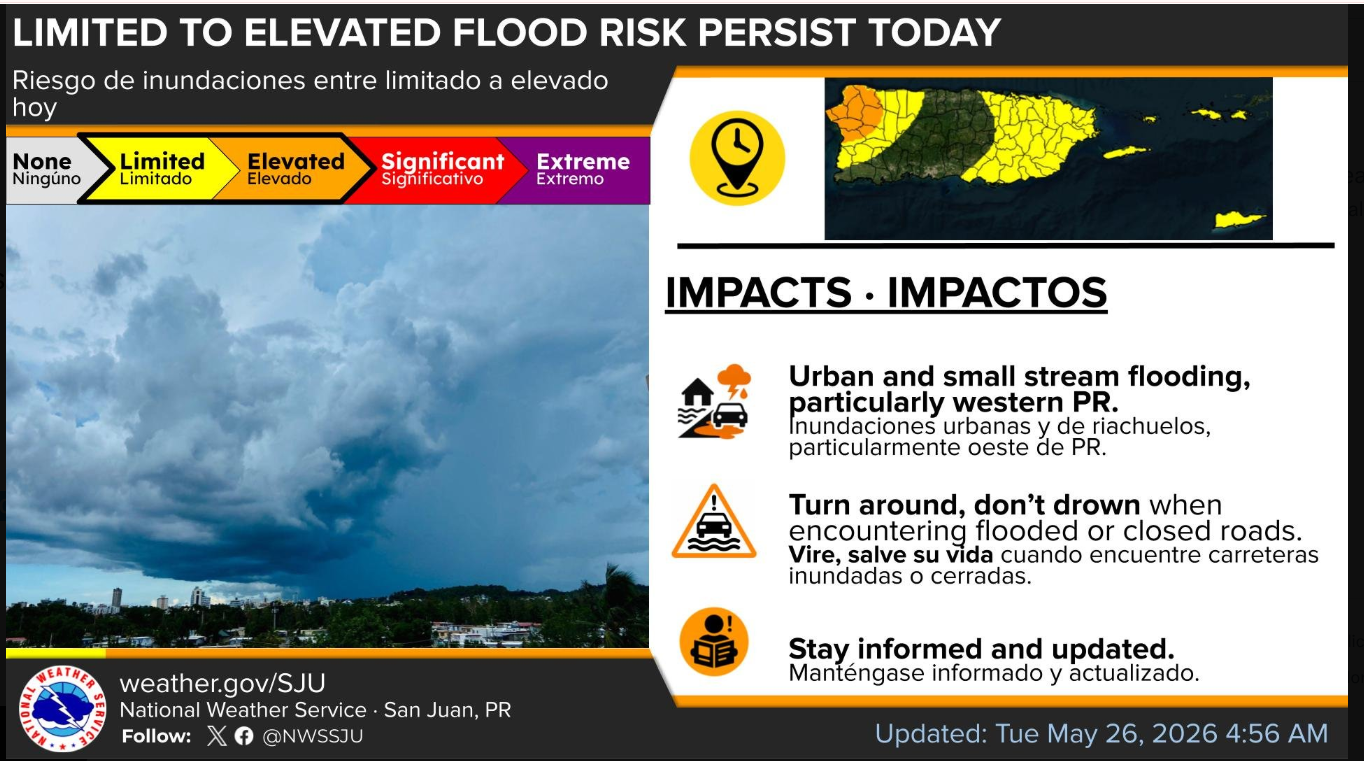
2. The Daily Rain: Passing Showers, But PR Takes the Brunt
The Reality: While western and interior Puerto Rico are facing elevated flood risks and afternoon thunderstorms due to sea breeze convergence, St. Croix is mostly looking at passing morning showers embedded in the trade winds.
The Impact: Expect brief ponding of water on the roads and in poorly drained areas during the morning hours, transitioning to clearer, breezier skies later in the day.
3. The Shift: Saharan Dust and 108°F Heat Indices Ahead
Looking Ahead: By Thursday and Friday, the moisture moves out, and a broad surface high pressure takes over.
The Impact: Winds will shift more from the southeast, bringing a massive warming trend. Combined with reduced cloud cover, heat indices are modeled to climb up to a scorching 108°F by the weekend.
The Dust: By Monday and Tuesday of next week, the GFS and ECMWF models are tracking a massive Saharan Air Layer (SAL) intrusion. Expect widespread hazy skies, dry conditions, and poor air quality.