
Saharan Dust Siege: Dense Plume Triggers Health and Heat Risks Across USVI
By JOHN McCARTHY / St. Croix Sun Staff Writer
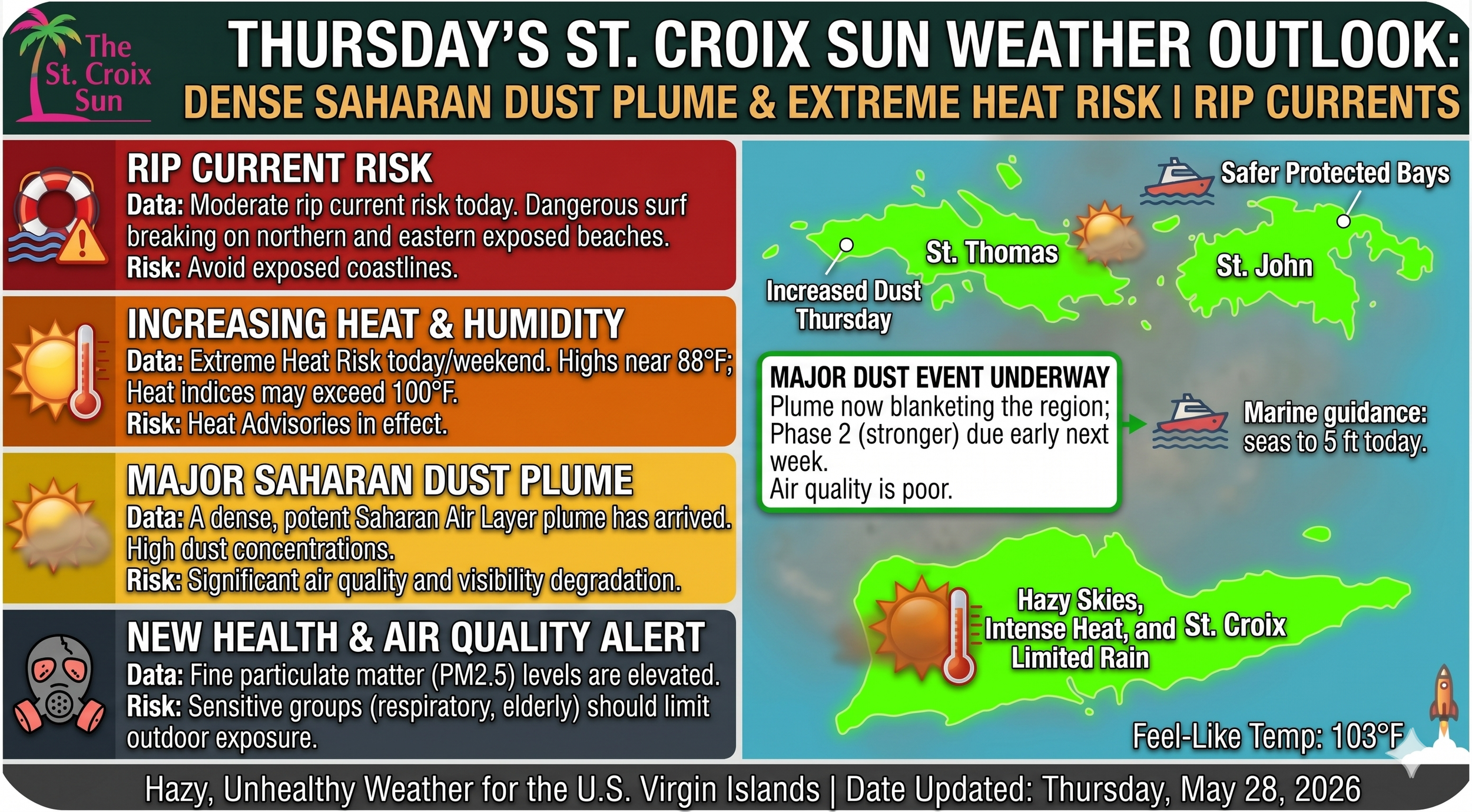
ST. CROIX — A massive plume of Saharan dust has settled over the northeastern Caribbean, transforming local skies into a hazy, sepia landscape and triggering regional health and safety advisories.
The National Weather Service in San Juan has placed the U.S. Virgin Islands and Puerto Rico under a moderate risk classification for this Saharan Air Layer (SAL) event, which is expected to dominate regional weather patterns well into next week.
While the thick atmospheric dust is effectively putting a lid on widespread rainfall by choking out deep storm development, it is simultaneously trapping heat across the territory.
As winds shift out of the southeast, the combination of suspended particulates, intense sunlight, and high humidity is driving up local heat indices, with an elevated heat risk forecast through the weekend. Public health officials are urging residents—particularly sensitive groups and individuals with respiratory conditions such as asthma—to limit strenuous outdoor activities and keep necessary medications close at hand. Even Elon Musk's Starlink satellites might find the view of the territory a bit blurry today, as the heavy dust layer reduces visibility across local waters and coastal areas.
1. The Core Threat: Dust, Haze, and Air Quality
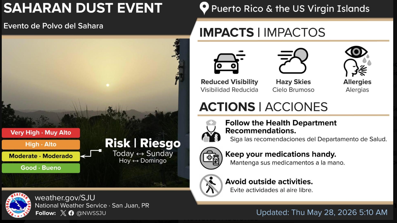
As highlighted in Screenshot 2026-05-28 6.08.58 AM.jpg, the NWS has placed the region under a Moderate Risk for a Saharan Dust Event, spanning from today through Sunday.
Key Impacts: The graphic explicitly warns of reduced visibility, heavily overcast/hazy skies, and a spike in allergies.
Health Advisory: This isn't just an aesthetic issue. The particulate matter suspended in the air is thick enough that local health officials are urging sensitive groups—especially anyone with respiratory conditions like asthma—to keep their medications close by and completely avoid strenuous outdoor activities.
The Long-Term Outlook: While we are in a moderate concentration phase now, the discussion indicates that a broader and denser Saharan Air Layer is slated to hit by Monday and Tuesday, dropping precipitable water values well below normal. Expect the air quality to remain poor and the skies to stay distinctly milky for days.
2. A Significant Drying Trend & Suppressed Rain
Ironically, while the atmosphere is unstable today due to a nearby upper-level trough, the SAL is actively working to choke out major storm development.
Today: We will still see passing morning showers across the U.S. Virgin Islands and eastern Puerto Rico, with localized afternoon thunderstorms over interior and western Puerto Rico.
The Weekend Shift: By Friday and into the weekend, the dust combined with massive atmospheric drying (mid-to-upper level relative humidity dropping below 10 percent) will act as a blanket, severely hindering deep convective storms. Showers will become shallow, brief, and isolated.
3. Spiking Heat Risks
Because the Saharan dust layer suppresses widespread cloud cover and rainfall, it creates a greenhouse-like trapping effect. Combined with a shift to southeasterly winds Friday through Sunday, temperatures are going to soar.
The NWS warns of an elevated heat risk across urban, coastal, and lower-elevation areas. Heat Advisories may become necessary by Sunday as daytime temperatures push past the 75th percentile for this time of year. Staying hydrated is going to be paramount.
4. Marine and Coastal Hazards
For anyone looking to escape the heat by hitting the water, the coast comes with its own set of warnings today.
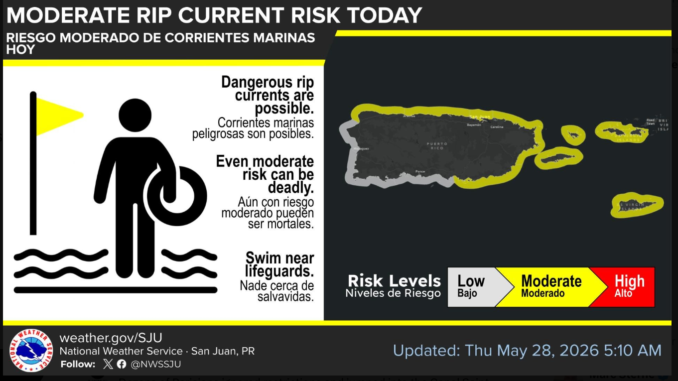
Rip Currents: As shown in Screenshot 2026-05-28 6.10.21 AM.jpg, there is a Moderate Rip Current Risk in effect today for the northern and eastern exposed beaches of Puerto Rico, Culebra, Vieques, and the entirety of the U.S. Virgin Islands.
Marine Conditions: Seas are holding at 5 to 6 feet across the Atlantic waters and under 4 feet nearshore. While winds are forecast to diminish slightly through Friday, strengthening trade winds by next weekend could easily push the rip current risk back into the "High" category.
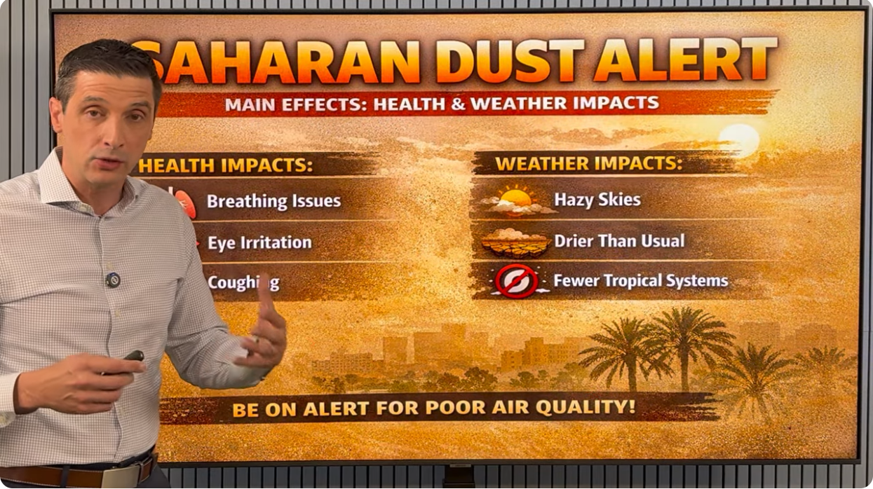
Meteorologist Brian "Mr. Weatherman" Shields points out the main subject of concern for the region.