High-Pressure Rhythms and Upper-Air Blues: The Long Weekend Weather Remix
By JOHN McCARTHY / St. Croix Sun Staff Writer
CHRISTIANSTED - The upper atmosphere is playing a tale of two tape tracks this Memorial Day weekend, transitioning from a smooth, stable jazz groove into an unstable, deep-convection jam by the holiday itself.
Right now, a mid-level ridge is building directly over the northeastern Caribbean, acting as the ultimate atmospheric bouncer. By compressing and stabilizing the air aloft, this ridge is keeping the weather relatively well-behaved, trapping what little moisture we have into a shallow layer below 700 millibars.
Combined with a powerhouse surface high over the north-central Atlantic that is keeping the local pressure gradient tight, this setup ensures our Friday and Saturday remain beautifully breezy, predictably sunny, and mostly dry, save for a few quick morning trade-wind showers passing over windward slopes.
But don’t get too comfortable with the status quo, because the upper-level rhythm section is about to change the beat. As we head into Sunday and Memorial Day Monday, that protective mid-level ridge is forecast to break down, giving way to an encroaching upper-level trough slinging cool air (down to $-8^\circ\text{C}$ at the mid-levels) right over the territory.
This cooling aloft will pull the plug on atmospheric stability, creating an "open-door" policy for deep convection. As the upper atmosphere unzips, a plume of rich tropical moisture will rush in to fill the void, sending precipitable water values climbing toward a soggy 2.0 inches.
For the holiday weekend's grand finale, expect the fast-moving morning breezes to yield to much deeper, slower cloud builds, bringing a heightened risk of widespread afternoon showers, localized urban ponding, and isolated thunderstorms to wrap up the long weekend.
💨 The Big Story: High-Velocity Wind Gradient
A tightening pressure gradient across the central Atlantic is acting like a giant leaf blower pointed directly at the Caribbean.
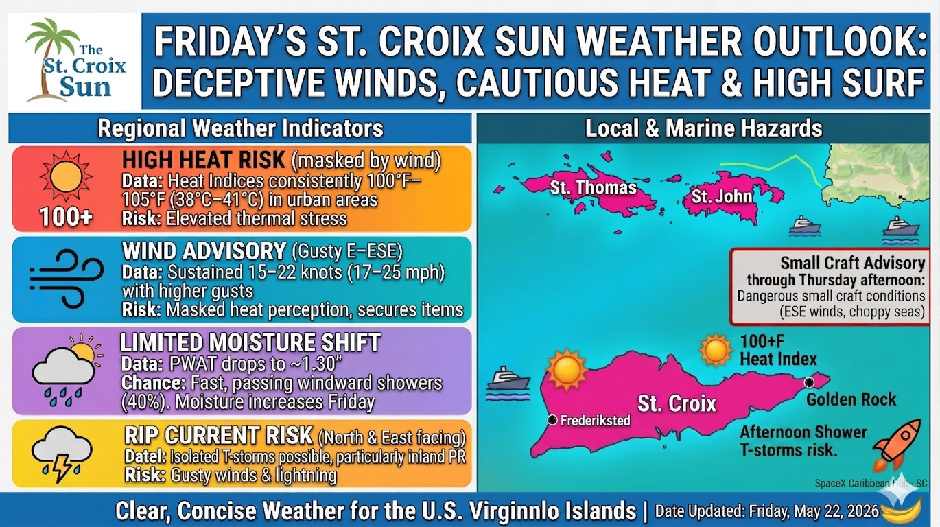
The Reality: East-southeast winds are blowing at 15 to 20 knots (17–23 mph), with significantly higher gusts expected throughout the day.
The Action Plan: Secure your loose outdoor patio gear, empty trash bins, and lightweight decor immediately. If you leave your favorite lawn chair unsecured, it might just launch itself into low-Earth orbit before lunch.
🌦️ Rain Checklist: Hit-and-Run Showers
Don't let the morning sunshine fool you; the atmosphere is feeling a bit erratic.
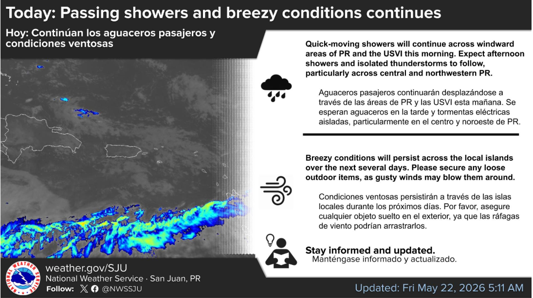
U.S. Virgin Islands: Expect a classic regime of quick-moving, wind-driven morning showers. Because the wind is moving so fast, these showers will scan across the islands rapidly, leaving behind mainly fair and dry conditions for the rest of Friday.
Puerto Rico: A pocket of shallow moisture will fuel afternoon showers and isolated thunderstorms. The main targets for heavy downpours, potential lightning, and sudden drops in visibility will be the central and northwestern regions, alongside the usual afternoon "El Yunque streamer" drifting into the San Juan metro area.
🌡️ The Comfort Index: "Feels Like" Triple Digits
The ambient air temperature will hover in the high 80s to low 90s, but that tells only half the story.
The Heat Index: Thanks to the lingering tropical humidity, the real-feel temperature will climb between 100°F and 105°F during peak afternoon hours.
The Strategy: The wind provides a nice illusion of cooling, but dehydration will still sneak up on you. Hydrate early and often if you are working or relaxing outdoors.
🌊 Marine & Beach Update: Choppy Waters
The high winds are keeping the local waters restless and uncooperative.
Boating: Small craft need to exercise caution, particularly out in the offshore Atlantic waters where choppy to rough seas will persist.
Swimming: There is a moderate risk of rip currents active for nearly all north- and east-facing beaches across the USVI and Puerto Rico. Keep your guard up, as these currents can easily catch even strong swimmers off balance.
🔮 Looking Ahead to the Weekend & Next Week
The breezy pattern isn't going anywhere, but the moisture levels will start to tick upward. Expect a noticeable increase in afternoon shower activity by Sunday, leading into an even more unstable, rainy stretch by next Tuesday and Wednesday. Enjoy the fast-moving nature of today's weather while it lasts!