THE INTERSTELLAR CONVEYOR: How an Atmospheric Engine Deflects Mainland Storms and Drops a Dust Blanket on St. Croix

🇺🇸 The Visual Wx Breakdown:
🔵 (Blue Circular Arrow - Major System): The dominant HIGH PRESSURE steering wheel. This is the heavy lifter. Its rotation is what pulls all that exceedingly dry, stable air (the beige dust veil) directly from Africa and across the Atlantic, guiding it like a laser beam toward the Lesser Antilles. This rotation is why our skies will look milky and haze-filled, effectively choking out any significant storm clouds or rain this weekend.
🔴 (Red Curved Arrow - Boundary to the North): This is that FRONTAL BOUNDARY that people on the mainland (and Canada/Mexico) are watching closely. In a different week, that red arrow might be aimed right at us, bringing severe weekend rain. But because of the big blue steering wheel (#1), this boundary is getting pushed and stretched, staying safely to our north and northeast, keeping its rain away from St. Croix.
🇺🇸⚪ (White Arrow & Labels - Local Impact): The "White and Blue" connection points. The large white arrow identifies that very specific patch of SAHARAN DUST—the result of the Blue/Red arrow interaction—which has now settled over us. It is labelled clearly: VEIL OF SAHARAN DUST (CHOKES OUT STORM RAIN). This "choking" action directly causes the bullet points listed under the white title on the right: Brilliant, stable weather (no rain); Gusty winds; Hazy heat.
By JOHN McCARTHY / St. Croix Sun News Reporter
ST. CROIX — While soccer fans across the territory are still buzzing from the USMNT’s historic 4-1 World Cup dismantling of Paraguay on the mainland, a completely different kind of global powerhouse is quietly dictating terms over our beaches this weekend.
Looking at the latest high-resolution GOES-19 satellite imagery, it is easy to see that the atmosphere doesn't care about borders or political lines. Instead, a massive, invisible high-pressure wheel spinning over the central Atlantic is acting as the ultimate atmospheric traffic cop—proving that what happens thousands of miles away on the North American continent shapes exactly how we experience paradise right here on the sand in St. Croix.
Up in the upper atmosphere, this massive high-pressure engine is locked in a high-altitude dance with a heavy weekend storm front moving across the U.S. mainland. But rather than allowing those severe rain systems to dip down into the Caribbean, the rotating gears of the Atlantic high are shoving those stormy frontal boundaries safely to our north and northeast. However, that security comes with a trade-off. As the system deflects the mainland rain, its southern edge is acting like a giant conveyer belt, dragging a thick, milky veil of Saharan dust straight out of Africa and draping it directly over the U.S. Virgin Islands.
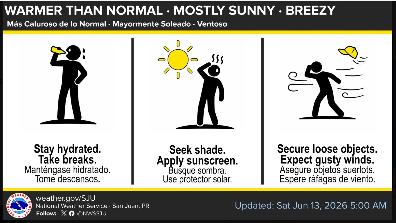
For beachgoers heading down to the shore today, this grand atmospheric connection means a weekend defined by dry, heavy stability. The incoming Saharan dust is working like an atmospheric blanket, effectively choking out any potential storm clouds and locking in sun-drenched, hazy skies alongside a fierce summer sizzle that will drive heat indexes into the triple digits. Backed by brisk 15 to 20-knot trade winds that are kicking up a lively 4 to 6-foot chop in the local passages, the message from the satellite is clear: it’s a brilliant, beautiful, and breezy Saturday to enjoy the territory, provided you stay hydrated and keep a watchful eye on those active surf zones.
☀️ The Big Picture: Heat, Dust, and Wind
The name of the game for the next few days is dry stability. A broad high-pressure system over the North Atlantic is acting like a atmospheric traffic cop, steering a brisk east-to-southeast trade wind flow right over the Virgin Islands and keeping things very consistent.
The Heat Index: While the actual air temperature will hover in the upper 80s, the humidity and intense June sun will drive daytime heat index values into the upper 90s and lower 100s. It’s a standard Caribbean summer sizzle, but it means hydration is key if you're out and about.
Hazy Horizons: The low-to-moderate concentrations of Saharan dust are reinforcing this dry pattern. It’s going to keep the skies looking a bit hazy and milky through the weekend, which might irritate sensitive respiratory systems but will successfully choke out any significant rainfall.
Breezy Conditions: Those east-southeast winds are going to be moving at a healthy clip today—climbing to 15 to 20 knots (about 17 to 23 mph) with even higher gusts during the afternoon. Secure any loose items on the porch or patio!
🌊 Marine & Beach Outlook: Choppy Waters
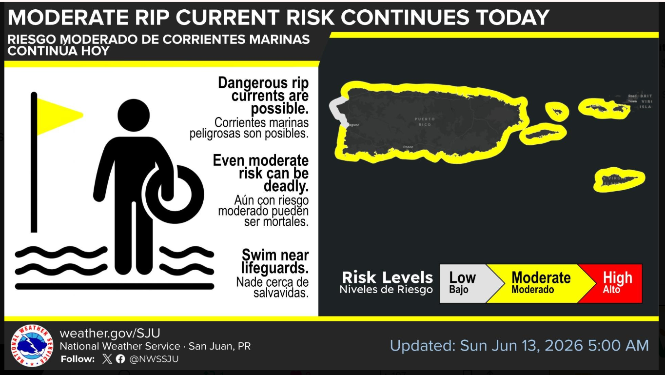
If you look at the NOAA infographic you shared, the entire perimeter of the U.S. Virgin Islands is highlighted in bright yellow.
Moderate Rip Current Risk: The National Weather Service has maintained a Moderate Risk of rip currents for all of our north-, east-, and south-facing beaches. The brisk trade winds are whipping up the surf zone, making life-threatening rip currents entirely possible. If you’re heading down to the water, stick to areas with lifeguards and don't underestimate the undercurrents.
Seas Building: For the local mariners and boaters, that strengthening Atlantic high is making the local passages a bit lively. Expect choppy marine conditions with seas building between 4 to 6 feet. Small craft operators definitely need to exercise caution over the next few days.
🔮 Looking Down the Road (The Long Term)
This stable, hazy, and breezy pattern is going to lock us in right through Tuesday and Wednesday. However, if you peek further down the discussion, the meteorologists are watching an upper-level low expected to develop northeast of the islands by the end of next week (around Thursday or Friday).
If that low combines with an incoming tropical wave, it could finally break this dry spell and bring some highly beneficial, soaking rains to the Virgin Islands to help combat our abnormally dry conditions. We'll keep an eye on how that system evolves as the week progresses.
In the meantime, it's a beautiful, breezy, and bright Saturday in the territory. Perfect weather to stay cool inside and watch the news feed take off!