# THE ST. CROIX SUN WEATHER CENTER
A ‘Notable’ Saturday: The Watch Begins as Atlantic Tropical Outlooks Resume
By JOHN McCARTHY / St. Croix Sun Staff Writer
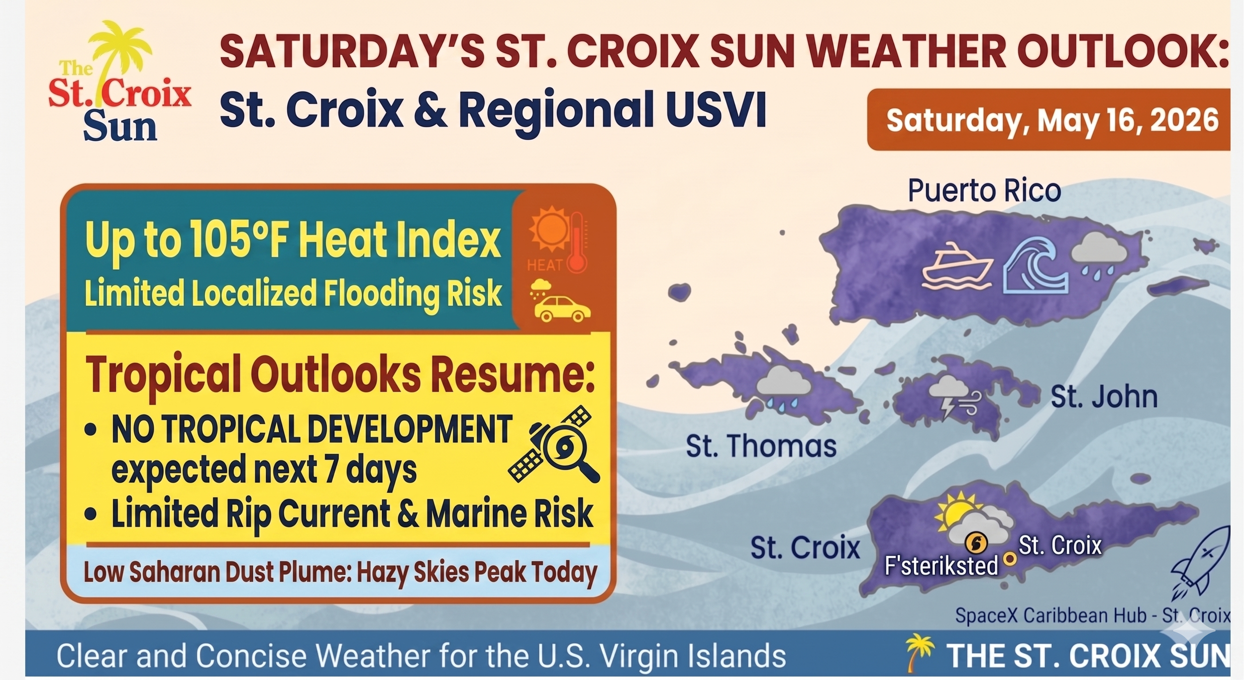
ST. CROIX — Saturday, May 16, 2026, marks a distinct turning point for the U.S. Virgin Islands. While local skies show a familiar mix of hazy sunshine and passing moisture, the broader meteorological calendar officially shifted into pre-season vigilance this weekend. The National Hurricane Center (NHC) has issued its first daily Tropical Weather Outlooks for the 2026 Atlantic season.
Though the NHC confirms that no tropical cyclone formation is expected over the next seven days, the return of these scheduled four-times-a-day updates serves as a firm reminder that the June 1 start date is rapidly approaching.
Locally, today's conditions provide a microcosm of early-season atmospheric dynamics, combining Saharan dust, intense afternoon heat, and incoming tropical moisture.
## Today’s Main Conditions (Saturday, May 16)
The Watch is On: Daily tropical updates from the NHC have officially resumed (issued at 2 and 8, morning and night). For the local islands, the Atlantic, Caribbean, and Gulf are currently quiet, but the tracking machinery is now fully operational.
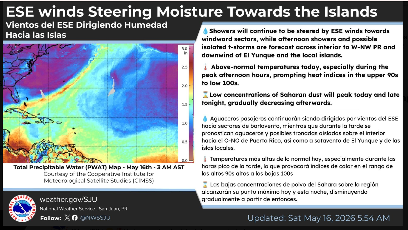
Dangerous Afternoon Heat: Driven by an east-to-southeast wind flow, daytime highs will climb into the upper 80s and lower 90s across coastal and urban areas. When factoring in the heavy tropical moisture, heat indices are forecast to skyrocket between $100^\circ\text{F}$ and $105^\circ\text{F}$ during peak afternoon hours. Residents are urged to minimize strenuous outdoor activity.
Peak Saharan Dust: A low-concentration plume of Saharan dust is expected to reach its peak density today and late tonight. This will keep skies visibly hazy and may irritate sensitive respiratory systems before the plume begins to gradually thin out tomorrow morning.
Passing Showers: Windward sectors are seeing brief, steering-wind showers this morning. As daytime heating takes over this afternoon, expect isolated shower development downwind of the local islands and El Yunque.
## The Week Ahead: Trough Approaching
The relative stability of the past few days is beginning to erode. An upper-level trough is drifting into the region from the west, weakening the high-pressure ridge overhead.
Sunday & Monday: Expect an increase in atmospheric instability. While there will still be plenty of breezy, sun-filled intervals, the frequency of passing showers and isolated afternoon thunderstorms will tick upward. This creates a limited-to-elevated risk for localized ponding on roadways and minor urban flooding.
Mid-to-Late Week: A more pronounced transition toward a wet, unstable weather pattern is anticipated. A deep upper-level trough sinking south over the western Atlantic will provide stronger atmospheric divergence aloft. While the enhanced rainfall will help mitigate ongoing local drought concerns, it will steadily elevate the risk of urban and small-stream flooding by the latter half of the workweek.
## Marine & Surf Outlook
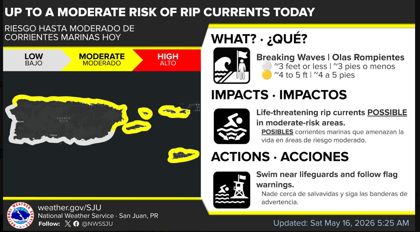
Rip Current Risk: A moderate risk of life-threatening rip currents remains active along the northern, eastern, and southern beaches of St. Croix, St. Thomas, St. John, and Puerto Rico. Beachgoers should remain cautious near reefs, jetties, and open bays.
Choppy Seas: Surface high pressure over the central Atlantic is maintaining moderate to fresh easterly to east-southeasterly winds. These breezy conditions will keep local marine waters choppy, with offshore and exposed wave heights holding steady between 4 and 6 feet through the weekend.