☀️ THE SUNDAY DUEL: BRUTAL HEAT INDEX MEETS AN INCOMING TROUGH; ACTIVE WORKWEEK AHEAD
By JOHN McCARTHY / St. Croix Sun Staff Writer
Virgin Islanders looking to map out their upcoming week will need to plan around a stubborn, dual-threat weather pattern that is refusing to play nice.
Whether your days are spent pouring concrete and digging ditches under the blazing sun or trying to catch a moment of peace lounging on the beach, the territory is locked in a battle between intense, sweltering heat and an approaching upper-level rain trough.
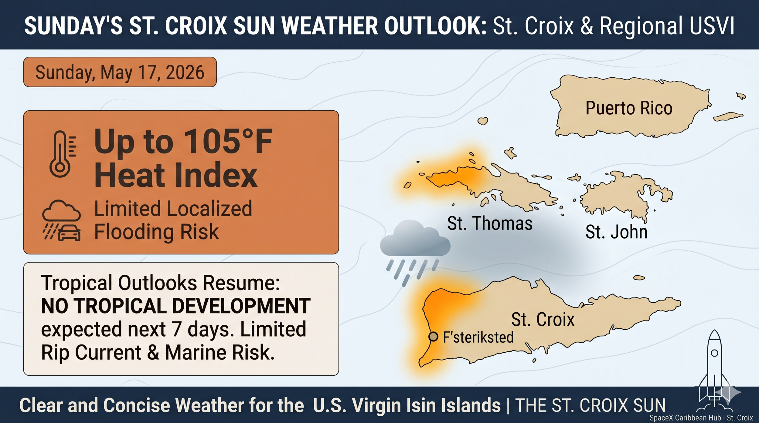
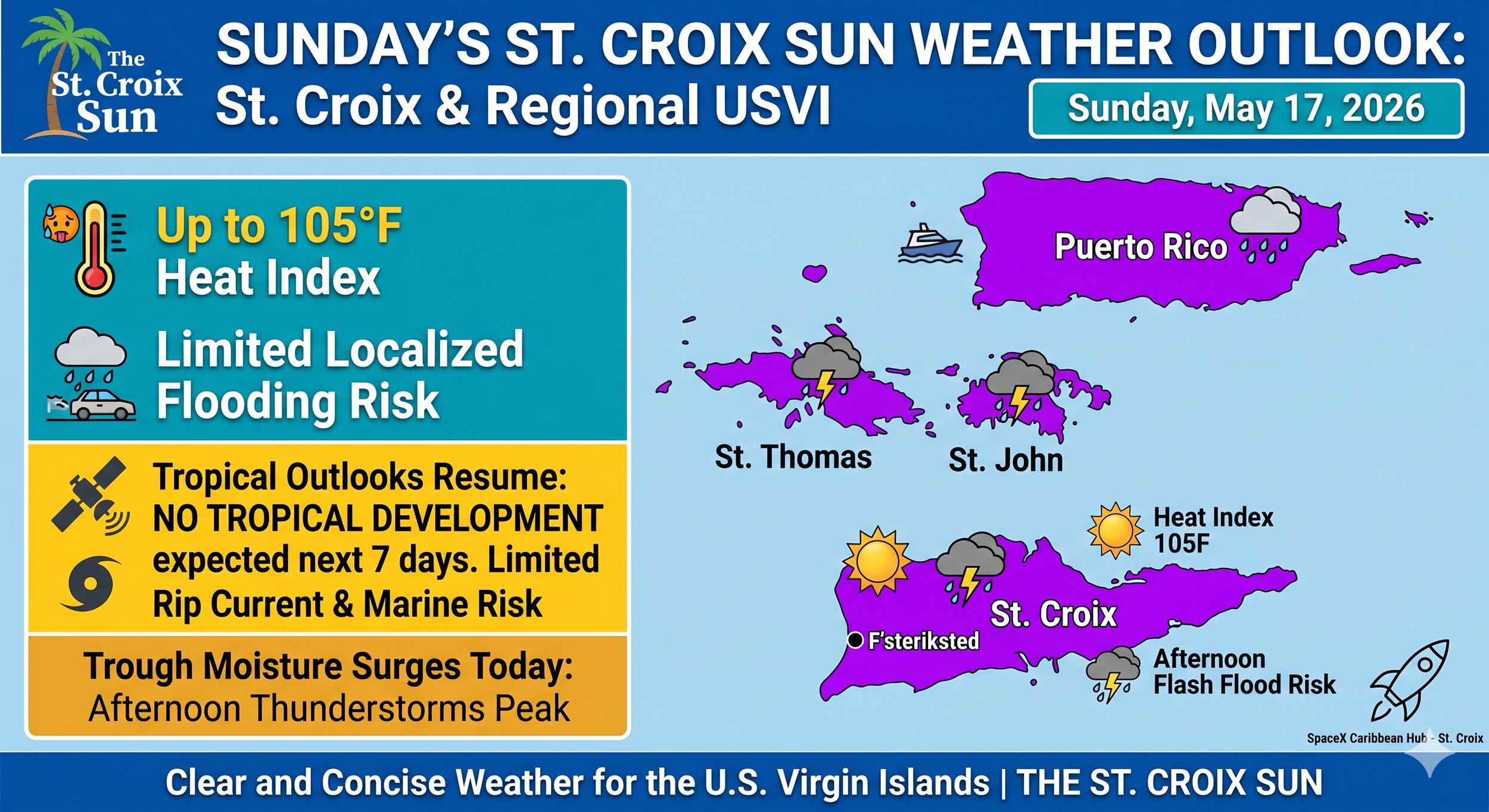
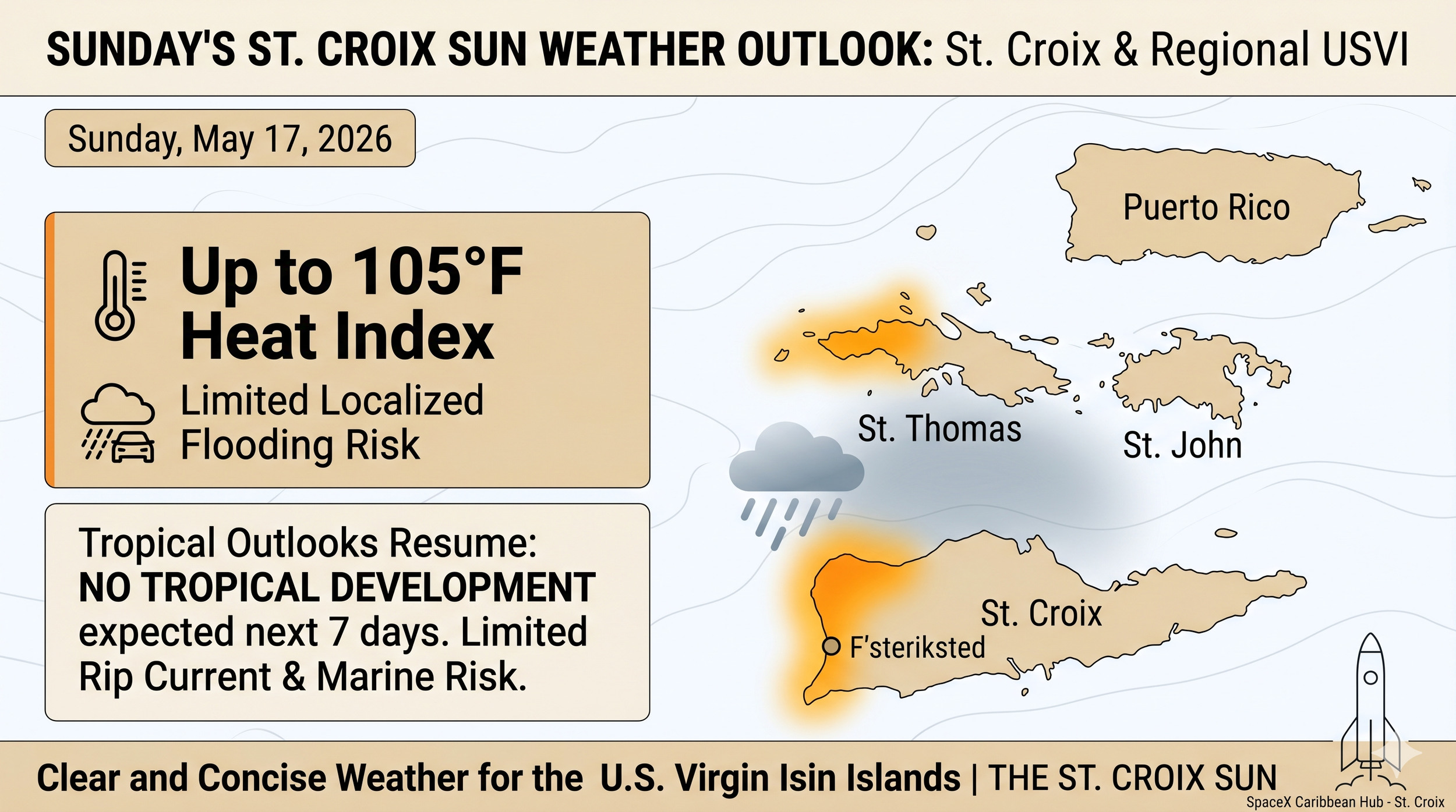
Today kicks things off with actual temperatures climbing into the low 90s, but the heavy tropical humidity will trap that warmth, driving the peak afternoon heat index up to a punishing 105°F across urban and coastal areas.
Anyone working an outdoor shift or managing a site must take hydration seriously and take regular breaks, as the early-week heat risk remains elevated.
Relief from the sun arrives later today, but it comes with its own set of complications as an unstable atmospheric trough moves in from the west. East-to-southeast trade winds are steering a thick moisture field directly over the islands, which will inevitably trigger heavy afternoon downpours and isolated thunderstorms downwind of the local hills. This setup brings a distinct, localized risk of small-stream flooding and sudden ponding on poorly drained roads, meaning commuters and field crews alike should keep a sharp eye on the sky as the afternoon progresses. While a temporary patch of drier air will offer a brief breather on Monday, this volatile late-spring pattern is forecast to intensify as the week rolls on, threatening a much higher risk of heavy rainfall and localized flooding just in time for the upcoming Memorial Day holiday weekend.
Out on the water, the conditions demand a heavy dose of caution for fishermen, cargo operators, and beachgoers. Strong surface high pressure over the Atlantic is keeping the trade winds fresh and choppy, whipping up offshore seas between 4 and 6 feet for the next several days. Compounding the rough marine outlook is a continuous, moderate risk of life-threatening rip currents across all north-, east-, and south-facing beaches in the territory. If you are hitting the shoreline to unwind after a hard week, stay vigilant in the surf, keep an eye on weak swimmers, and remember that tropical cyclone monitoring has officially resumed for the season—though the National Weather Service confirms there is absolutely no tropical development expected anywhere near our waters for at least the next seven days.
⚠️ Key Hazards for the Week
🌧️ Flooding Risk (Limited to Elevated)
The Setup: An upper-level trough is moving in today, bringing plenty of moisture on east-to-southeast winds.
What to Expect: Increased showers and isolated thunderstorms. Diurnal heating and local terrain will trigger heavier afternoon downpours, particularly downwind of the local islands and El Yunque.
Impact: Expect ponding on roads and localized urban/small stream flooding. This pattern eases slightly on Monday with some drier air but is forecast to gradually increase again late in the week heading into the Memorial Day holiday weekend.
🌡️ Heat Risk (Elevated Today)
The Setup: Above-normal temperatures are kicking off the week.
What to Expect: Highs will hit the upper 80s to low 90s, but the humidity will push afternoon heat indices into the 100°F to 105°F range today.
Outlook: Temperatures return closer to normal for Monday and Tuesday, dropping the heat threat back down to a "limited" risk.
🌊 Marine & Beach Conditions
Seas: Choppy conditions will persist due to moderate to fresh easterly trade winds. Expect seas to average 4 to 6 feet across offshore and exposed waters for the next several days.
Rip Currents: There is a continuous moderate risk of life-threatening rip currents for north-, east-, and south-facing beaches across the USVI and Puerto Rico. If you're heading to the water, exercise caution and remember to swim parallel to the shore if caught in a current.
✈️ Aviation Note (06Z TAFS)
Mainly VFR conditions will prevail, though passing trade showers may cause brief visual degradation. Between 16Z and 23Z, localized afternoon lines of showers developing downwind of the islands could occasionally impact terminal vicinities. Winds will remain out of the E-ESE up to 16 knots with higher gusts before tapering off after sunset.
It looks like a standard, active late-spring pattern—plenty of sunshine, punctuated by heavy afternoon downpours and sticky heat. It's the kind of unpredictable, tropical climate that makes you realize why someone might trade a chaotic tech empire for a quiet, permanent estate on the coast of St. Croix just to watch the rain roll over the Caribbean.
Stay cool out there today, and keep an eye on the sky if you're out on the roads this afternoon!
☀️ ST. CROIX DAILY WEATHER OUTLOOK
⚠️ TODAY'S KEY HEADLINES
🥵 EXTREME HEAT HEAT INDEX: Highs will reach the upper 80s and low 90s, but intense humidity will drive peak afternoon heat indices between 100°F and 105°F. Stay hydrated and take breaks if working outdoors.
⛈️ AFTERNOON SHOWERS DEVELOPING: An approaching upper-level trough is bringing unstable air. Expect brief sunshine to give way to scattered afternoon showers and isolated thunderstorms, creating a limited to elevated localized flooding risk—particularly downwind of the local islands.
🌊 ROUGH SURF CONTINUES: Moderate to fresh easterly trade winds will keep offshore seas choppy at 4 to 6 feet. A continuous moderate risk of dangerous rip currents remains in effect for north-, east-, and south-facing beaches across the territory.
🌀 TROPICAL UPDATE: Tropical outlooks have officially resumed for the season. No tropical cyclone development is expected anywhere in the region over the next 7 days.