
THE DRY-SKY BUZZSAW: Will an Atmospheric Shield Disrupt the 2026 Hurricane Threat?
By JOHN McCARTHY / St. Croix Sun Staff Writer
ST. CROIX — As the official June 1 start date for the Atlantic hurricane season approaches, the standard barrage of national media warnings has begun spinning up to its usual peak seasonal alarm. However, an examination of the raw scientific models just released by the National Oceanic and Atmospheric Administration (NOAA) reveals a highly unusual and welcome protective barrier locking into place directly over our sector of the Caribbean.
Bucking the high-activity trend of recent years, federal meteorologists have bucked expectations by projecting a 55% chance of a below-normal season across the Atlantic basin, estimating a total of only 8 to 14 named storms, 3 to 6 hurricanes, and 1 to 3 major hurricanes. For residents of St. Croix and Puerto Rico looking for a reprieve, the macro-environmental setup is showing early signs of delivering a formidable defensive grid.
The Pacific Shear Engine
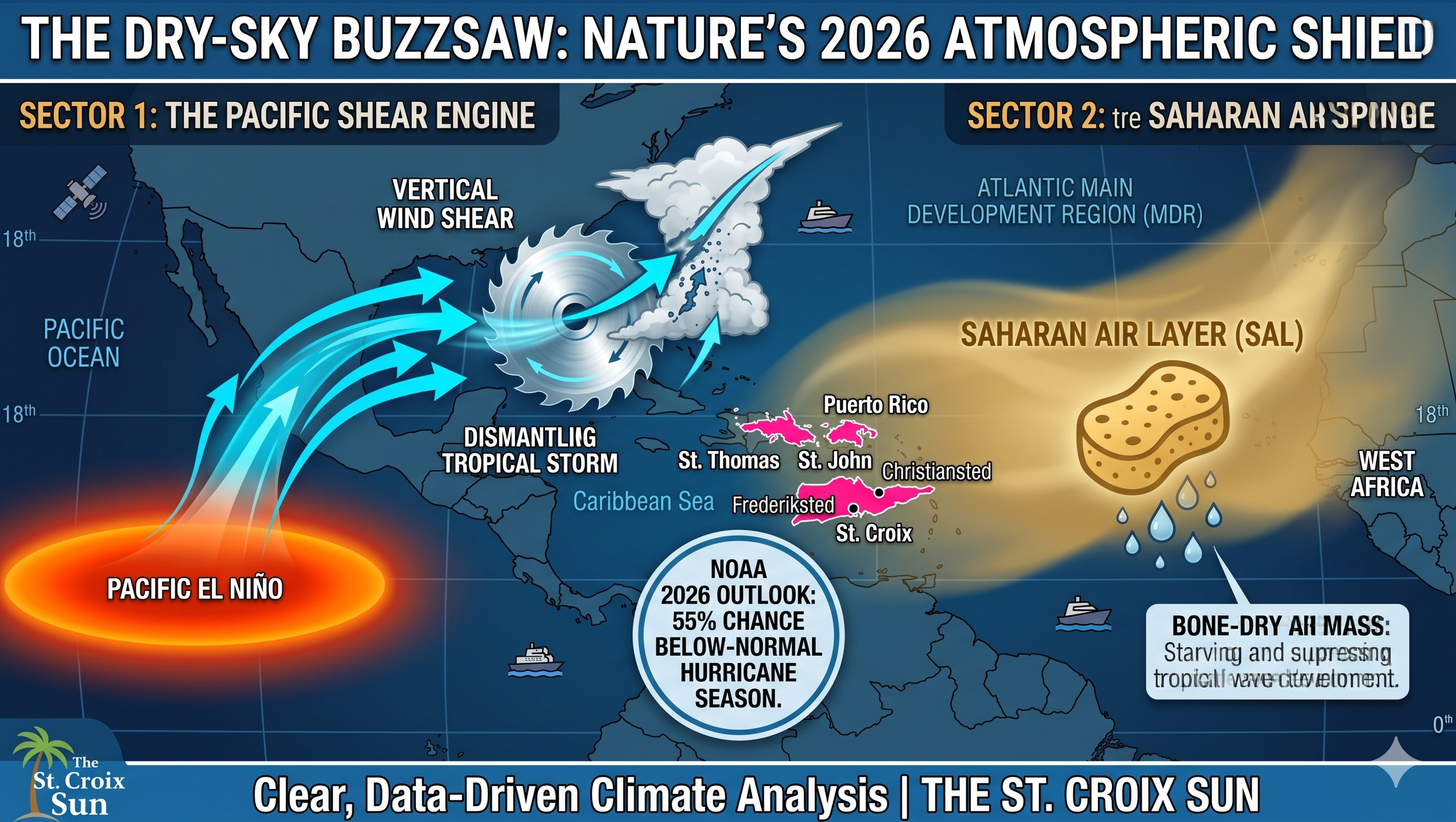
The primary engine driving this massive downward shift in storm probability is a rapidly intensifying El Niño pattern currently anchoring itself across the Pacific Ocean. While located thousands of miles away, a strong El Niño exerts a powerful, teleconnected influence over the Atlantic Main Development Region (MDR).
Specifically, it unleashes an intense, high-altitude westerly wind configuration across the Caribbean. This acts as a literal "atmospheric buzzsaw," generating severe vertical wind shear that physically tilts and shreds nascent tropical waves before their convective cores can align, close their circulations, and intensify.
The Saharan Air Sponge
Compounding this hostile upper-level wind shear is a dense, robust influx of the Saharan Air Layer (SAL) currently tracking across the Atlantic and slated to envelop the territory next week.
While the suspension of fine dust particles frequently dulls our horizons and triggers local air quality alerts, the macro-scientific value of these plumes cannot be overstated. The Saharan Air Layer is characterized by an exceedingly hot, bone-dry, and highly stable air mass. It operates like a giant atmospheric sponge, aggressively starving tracking tropical waves of the deep mid-level moisture necessary to fuel intense thunderstorms.
Furthermore, the dense dust layer blocks and reflects incoming solar radiation, effectively cooling sea surface temperatures in the eastern Atlantic while reinforcing a low-level trade wind inversion. When a tropical wave steps into this envelope of dry air, its updrafts are rapidly choked off by entrainment, causing the system to collapse under its own weight.
Nature’s Protective Grid
While local emergency management agencies rightly emphasize that it only takes one tracking system to redefine a season, the coexistence of an active Pacific wind-shear engine and aggressive, early-season Saharan dust plumes gives the territory an undeniable atmospheric shield heading into the summer months.
For the maritime and coastal infrastructure anchoring the 18th parallel, this "dry-sky buzzsaw" represents a critical tactical buffer, offering a data-backed silver lining that stands out starkly against standard seasonal anxieties.
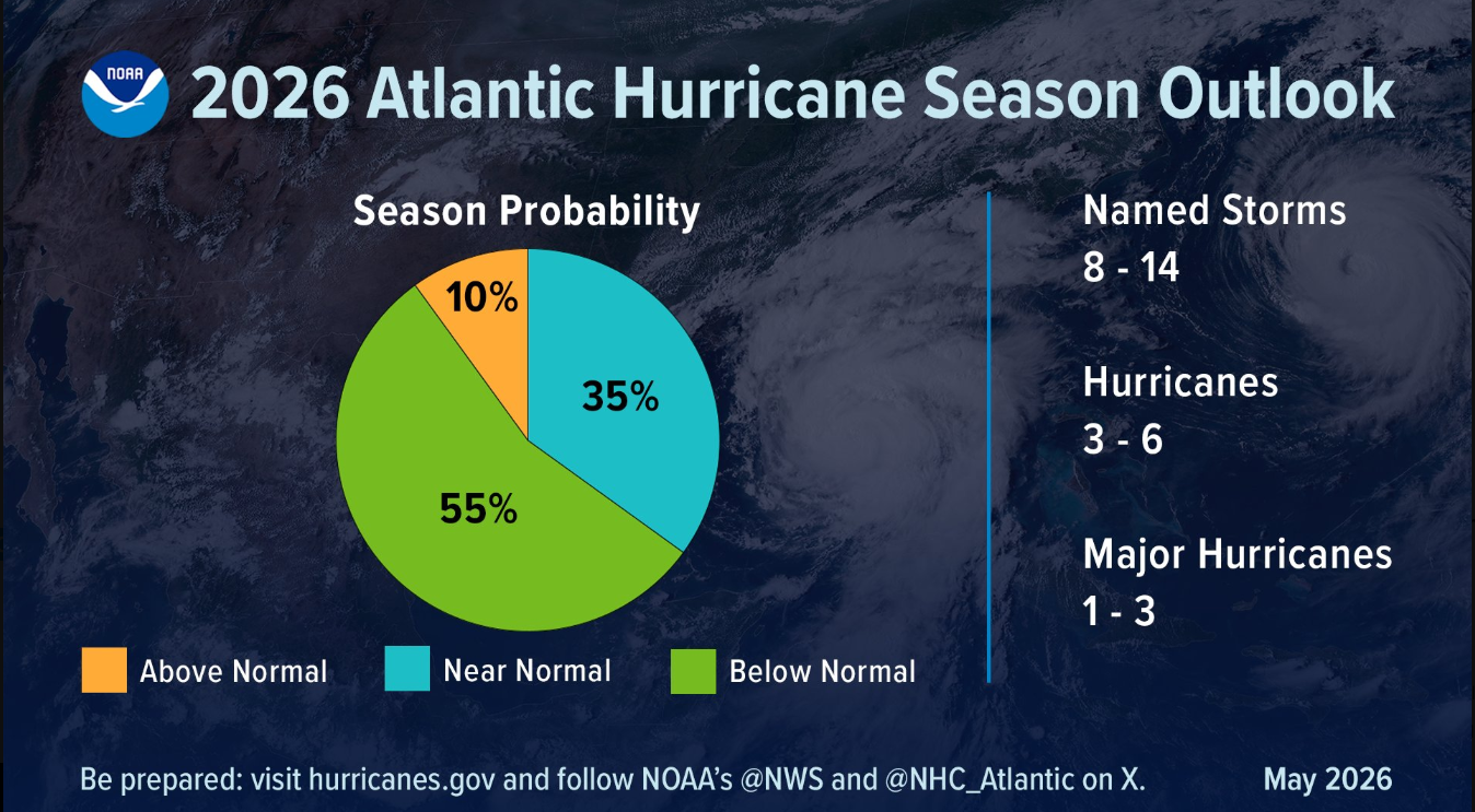
(Source: NHC)
