
The Dust Before the Storm: Saharan Shield Greets Official Start of 2026 Atlantic Hurricane Season
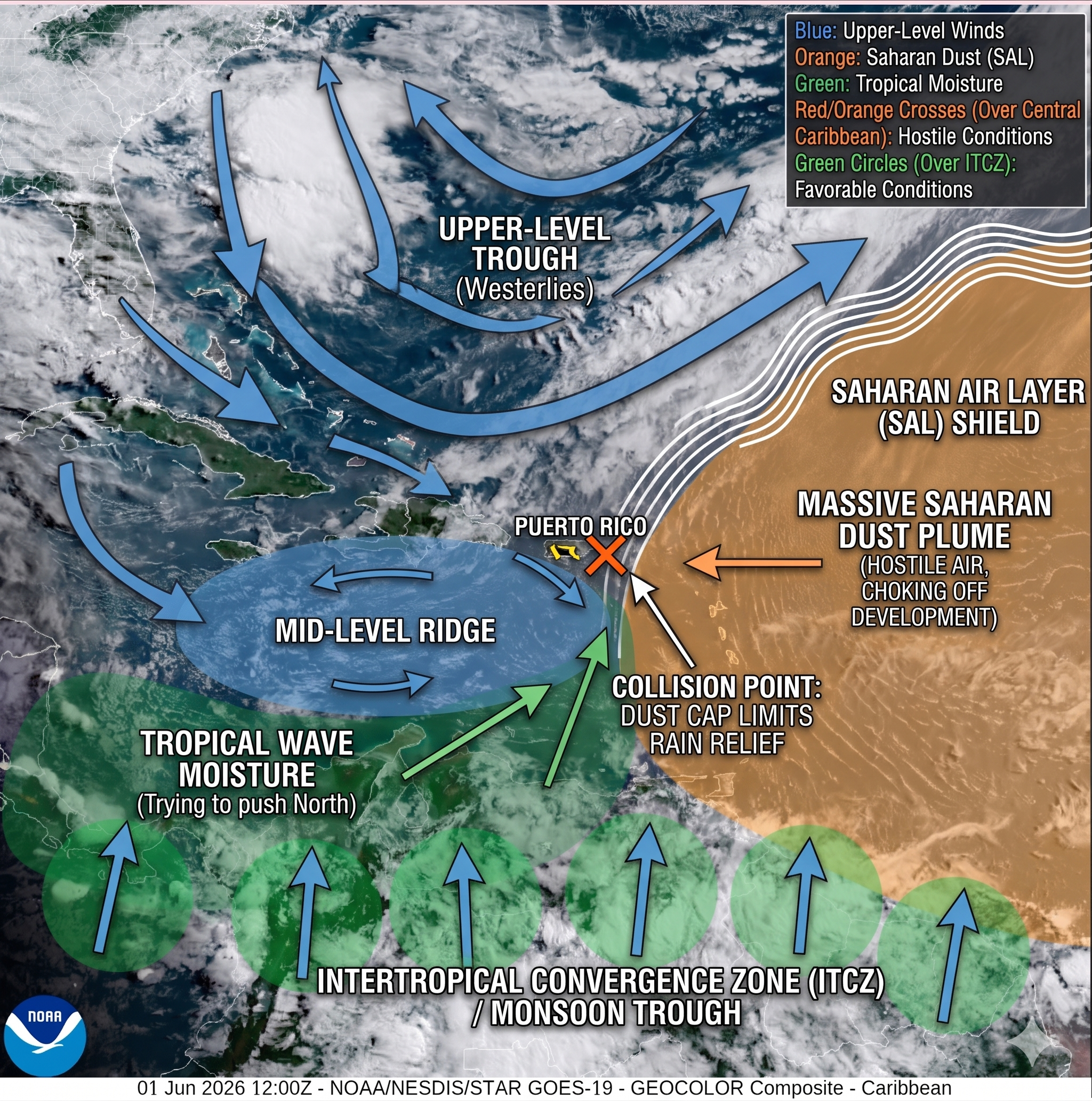
Satellite Analysis: NOAA GOES-19 Geocolor Composite imagery (June 1, 2026) capturing the atmospheric "clash of the titans" over the northeastern Caribbean on opening day of the Atlantic hurricane season. The annotated overlay highlights a massive, hostile Saharan Air Layer (SAL) plume (orange) acting as an atmospheric brick wall to the east, effectively capping and choking off a reservoir of tropical wave moisture (green) trying to push north. The exact collision point directly over St. Croix visualizes why vital rain relief remains suppressed across the Virgin Islands, leaving the territory with hot, dry, and heavily hazy conditions. (NOAA / St. Croix Sun)
By JOHN McCARTHY / St. Croix Sun Staff Writer
ST. CROIX — On this first day of June, the calendar tells us the 2026 Atlantic Hurricane Season has officially arrived, but the horizon tells a different story. While the date usually sparks a nervous scan of the tropics for organized convection, residents of the U.S. Virgin Islands woke up today to a milky-gray sky—the result of a massive, "hostile" plume of Saharan dust that has effectively swallowed the Caribbean.
As seen in the latest NOAA Geocolor imagery, this dense Saharan Air Layer (SAL) is currently acting as a continent-sized shield, choking off moisture and providing a temporary, dry barrier against early-season development. However, while the dust may keep the tropics quiet, it presents an immediate, highly visible hazard to local air quality and public health.
Today, as we look through the haze at the months ahead, the Free Press breaks down the dual reality of our June 1st kick-off: how to manage the respiratory hazards at our doorstep while utilizing this calm window to master seasonal readiness.
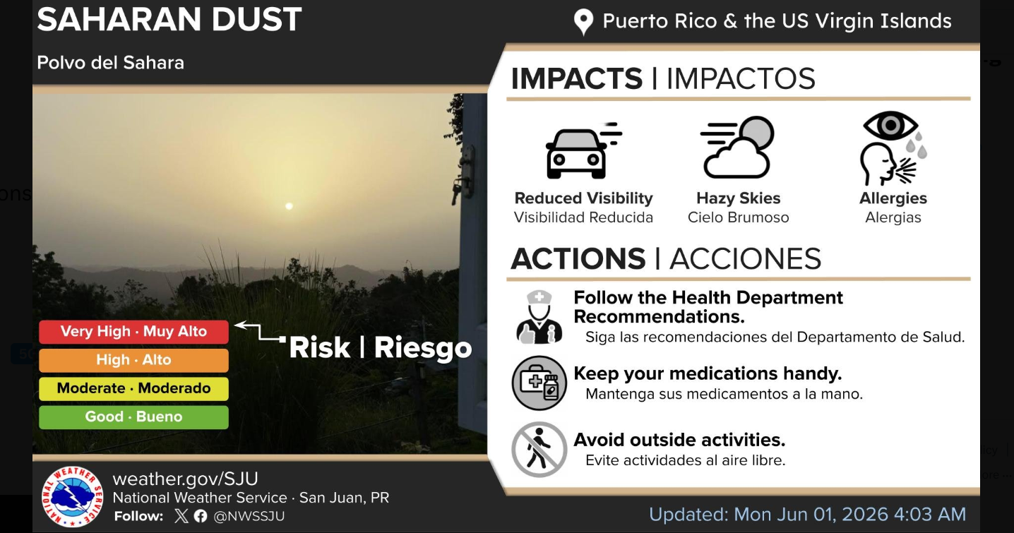
🛑 Key Public Health Alert: Saharan Dust
The National Weather Service has flagged a "Very High" risk level for Saharan dust across the territory today.
The Impact: Expect heavily reduced visibility (near 6 statute miles for aviation) and distinctly hazy skies through Tuesday.
The Outlook: A brief break is possible mid-week, but another moderate pulse of dust is already timed to arrive by the end of the workweek and linger through the weekend.
Recommended Actions: Sensitive groups, children, and individuals with respiratory conditions should limit outdoor exposure, keep medications close at hand, and follow local Health Department guidelines.
☀️ Short-Term Forecast: Today through Wednesday
Weather: Predominantly dry, stable, and hot conditions will prevail across St. Croix.
Rainfall: Strongly suppressed. While a few fast-moving, shallow trade wind showers or localized island "streamers" can't be completely ruled out during the early mornings, daily total accumulations will be practically non-existent.
Winds: Blowing fresh out of the east-southeast at 12 to 16 knots, with stronger localized gusts and sea breeze variations.
🌊 Marine & Beach Safety
Conditions: A tight pressure gradient means moderate to fresh winds will keep local waters quite choppy all week.
Rip Currents: There is a moderate risk of life-threatening rip currents across the majority of exposed beaches in the USVI. Beachgoers are urged to swim near a lifeguard and heed the advice of local beach patrols.
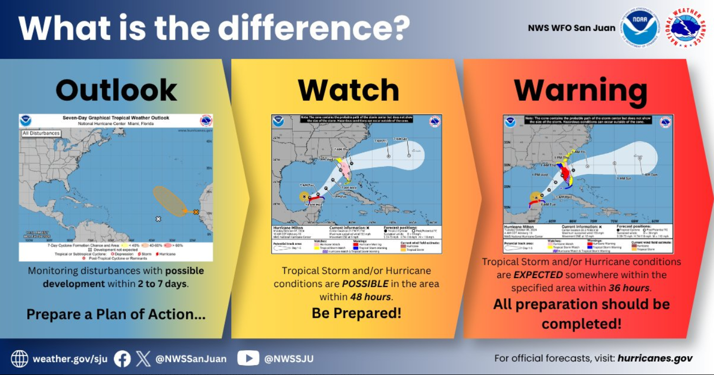
🌀 Hurricane Season Reminder: Master the Basics
Because today marks the official start of the season, the NWS urges residents to use this quiet, dust-suppressed week to review emergency protocols. Knowing the critical differences between tropical alerts can save lives later in the season:
Outlook: Monitoring potential development within 2 to 7 days. This is your cue to prepare a plan of action.
Watch: Tropical storm or hurricane conditions are possible within the area within 48 hours. This is your cue to be prepared and monitor updates.
Warning: Dangerous conditions are expected within the specified area within 36 hours. At this stage, all preparations should be completed immediately.
Fortunately, the long-term forecast notes that while a weak tropical wave will pass well south of the area by Friday or Saturday, its peripheral impacts on our weather will be minimal. Stay safe, stay inside where it's cool if you can, and use this calm window to ensure your household is ready for the months ahead.
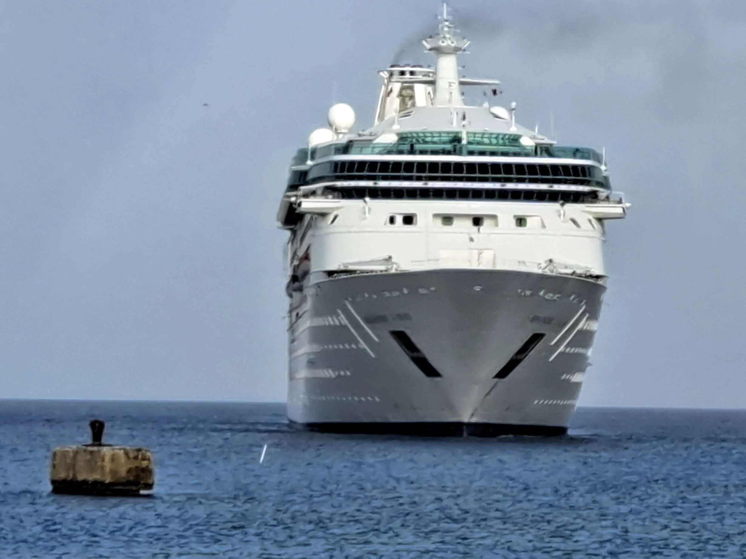
The camera is positioned low, near the water's surface, capturing a straight-on view of the massive bow of the cruise ship, Rhapsody of the Seas. The white vessel looms large against a hazy, overcast sky, moving slowly but steadily forward. A light trail of dark smoke vents from its funnel. In the lower-left foreground, a weathered, concrete mooring buoy sits anchored in the deep blue Caribbean water. The sea is calm with gentle ripples. (Photo by: JOHN McCARTHY / St. Croix Sun)