
💨 THE SAL DIARIES: Dense Saharan Dust and Spikes in Heat Headed for the USVI
By JOHN McCARTHY / St. Croix Sun Staff Writer
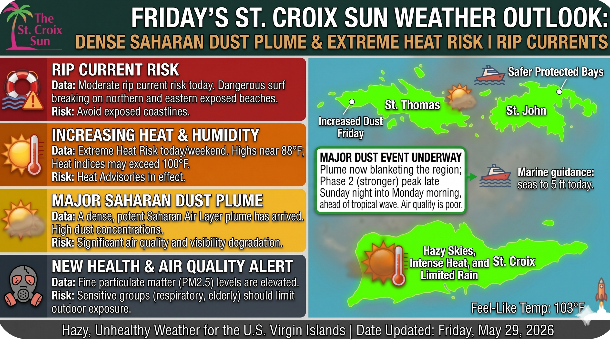
ST. CROIX / ST. THOMAS / ST. JOHN — If you woke up this morning noticing the horizon looking a bit more muted than usual, it’s not your eyes. A massive, dense plume of the Saharan Air Layer (SAL) is officially filtering into the territory, bringing a combination of hazy skies, dropped visibility, and an elevated heat index that will lock in through the weekend.
The National Weather Service’s Friday morning briefing indicates that while today marks the initial entry of the dust, the concentration is expected to peak late Sunday night into Monday morning.
Here are our “Notes From The Underground” so that you can navigate the weekend safely:
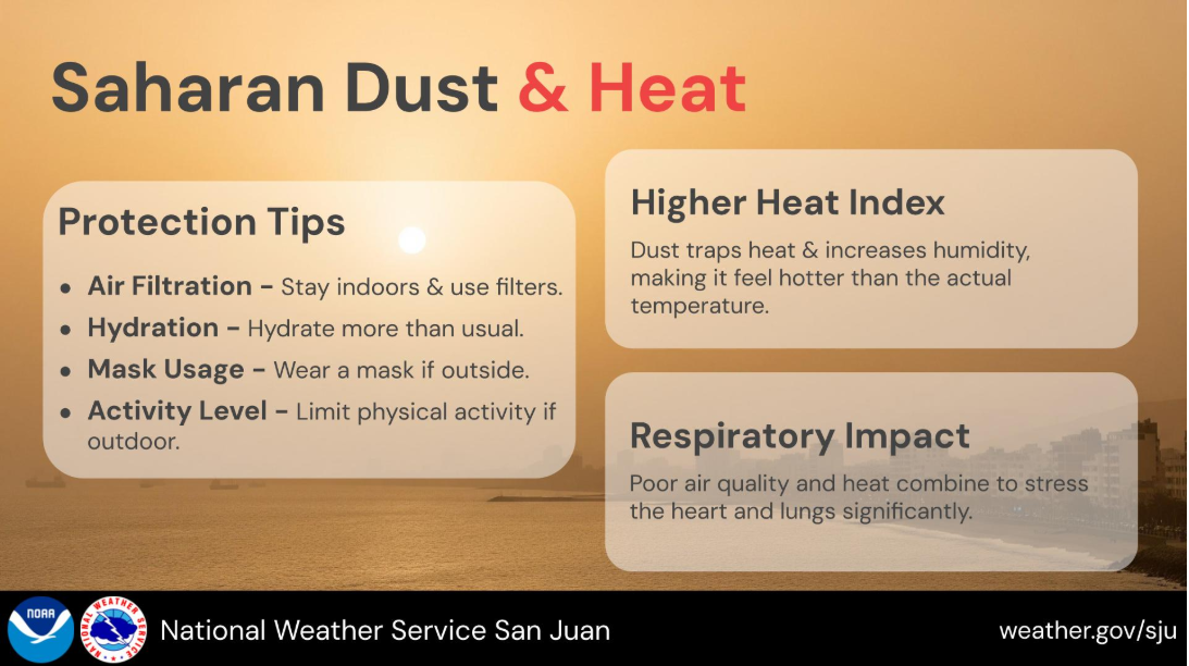
🌡️ The Dust-Heat Connection
It’s not just the sun making things uncomfortable this weekend. The suspended dust particulates act like an atmospheric blanket, trapping low-level moisture and heat while simultaneously reducing cloud cover.
The Result: Expect warmer-than-normal daytime temperatures across urban, coastal, and lower-elevation areas of the islands.
The Risk: The combination of intense afternoon heat, high humidity, and trapped dust will push the heat index into uncomfortable territory. Official Heat Advisories may become necessary by Monday.
🫁 Air Quality & Respiratory Health
Because this is a particularly dense plume, air quality is expected to deteriorate progressively over the next 48 to 72 hours.
Individuals with respiratory conditions, asthma, or heightened sensitivities are urged to take early precautions.
Consider limiting strenuous outdoor activities during peak afternoon heating hours, staying hydrated, and keeping air filtration systems running indoors.
🌊 The Marine & Weekend Outlook
The Waters: A high-pressure system over the central Atlantic is keeping easterly-to-southeasterly winds moving at a choppy 12 to 16 knots, keeping exposed seas around 4 to 5 feet (and occasionally up to 6 feet).
Beachgoers: A moderate risk of rip currents remains in effect for northern and eastern facing beaches across the islands.
The Twist: While the dust will suppress major rainmaker storms today and Saturday, a tropical wave is currently tracking toward the region. Current models show it bringing an influx of moisture by late Sunday into Monday, which could trigger an unsettled pattern of heavy showers right as the dust plume hits its peak.
Stay cool, keep the water bottles filled, and keep an eye on vulnerable neighbors as this heavy haze rolls through.
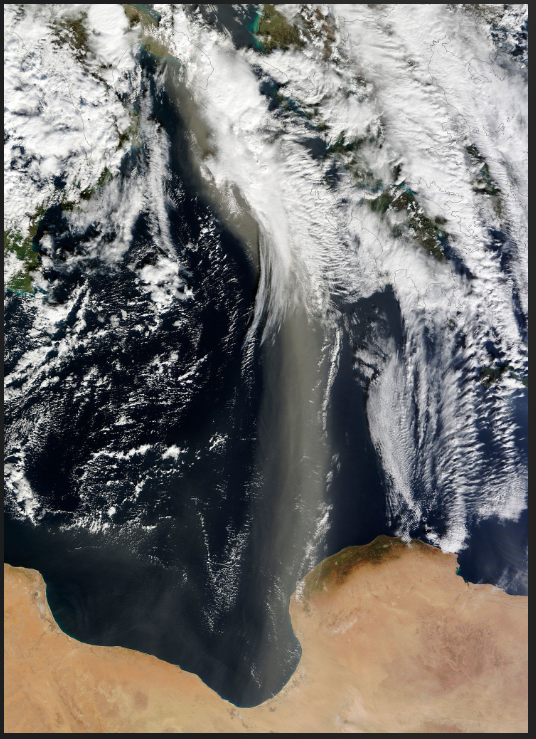
Saharan Air Layer tracking across the Atlantic. Source: Stocktrek Images / Getty Images