
THE WEST END DUST BOWL: Saharan Air Layer and Frederiksted Roadwork Deliver a Cruel 'Double Whammy'
Hazy Skies Offer Minor Reprieve on Paper, But Sinuses Territory-Wide Say Otherwise
By JOHN McCARTHY / St. Croix Sun News Reporter
FREDERIKSTED — If your eyes are watering, your throat is scratchy, and you’ve been driven to ground inside an air-conditioned room today, you are certainly not alone.
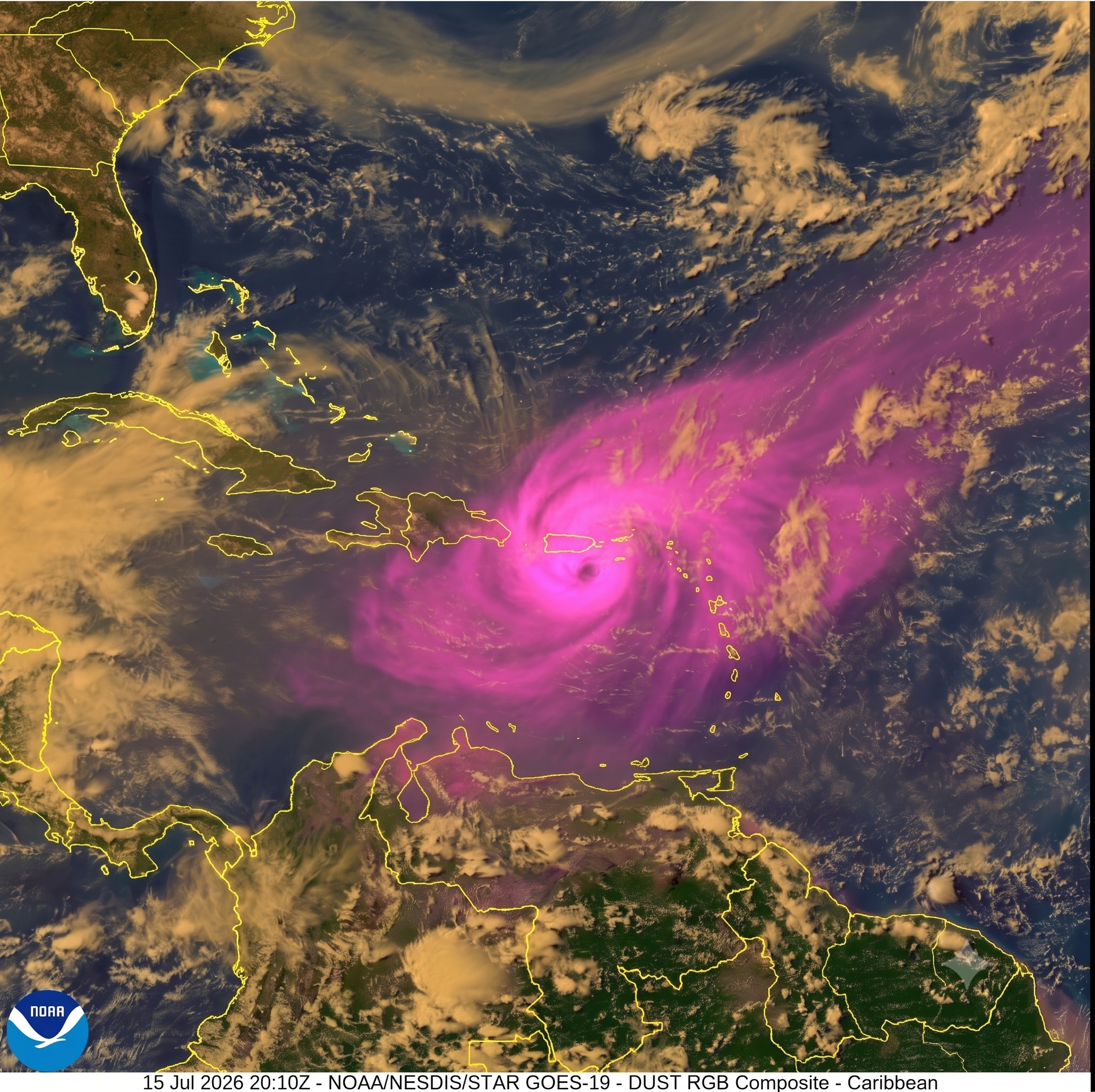
While the National Weather Service in San Juan reports that Saharan dust concentrations have technically continued to decrease compared to the thick, oppressive blankets of earlier this week, the atmosphere over St. Croix remains far from pristine. Occasional pockets of light dust continue to drift across the USVI, maintaining a persistent haze over the horizon.
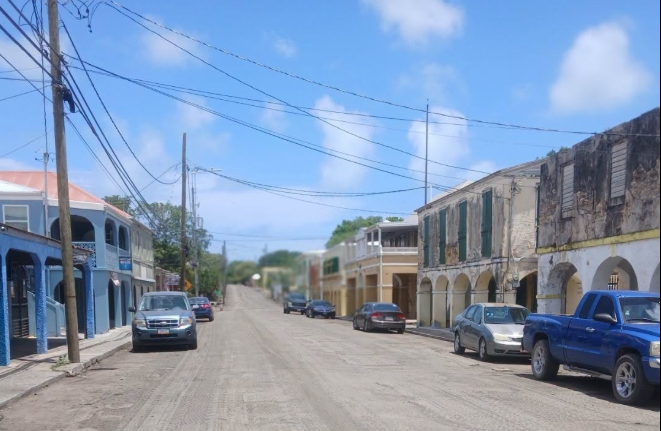
For residents on the West End, however, the meteorological relief is a total illusion. Thanks to the massive road rehabilitation project currently underway in downtown Frederiksted, Strand, King, Queen, and Fisher streets have essentially been converted into active dust bowls. The fine, pulverized asphalt kicked up by heavy milling equipment is swirling directly into the trade winds—combining with the remaining Saharan Air Layer (SAL) to deliver a textbook "double whammy" to local sinuses. It is a dust storm of epic proportions, thick enough to make even a stainless-steel Tesla Cybertruck parked on Strand Street look like it just completed a dusty transit across the plains of Mars.
(Facebook / DPW)
Cooler at Sunrise, But Muggy Hours Ahead
There was a brief moment of comfort for early risers this morning, with St. Croix temperatures reading a relatively pleasant 79 degrees Fahrenheit around 5:45 a.m.
Unfortunately, that relief is strictly temporary. While high temperatures today will hover near seasonal normals in the upper 80s to low 90s, a surging wave of low-level moisture is on the way.
A retrograding Tropical Upper Tropospheric Trough (TUTT) is currently shifting across the northeastern Caribbean, bringing marginal instability. Combined with a weak trade wind perturbation, moisture levels are projected to rise significantly by this afternoon.
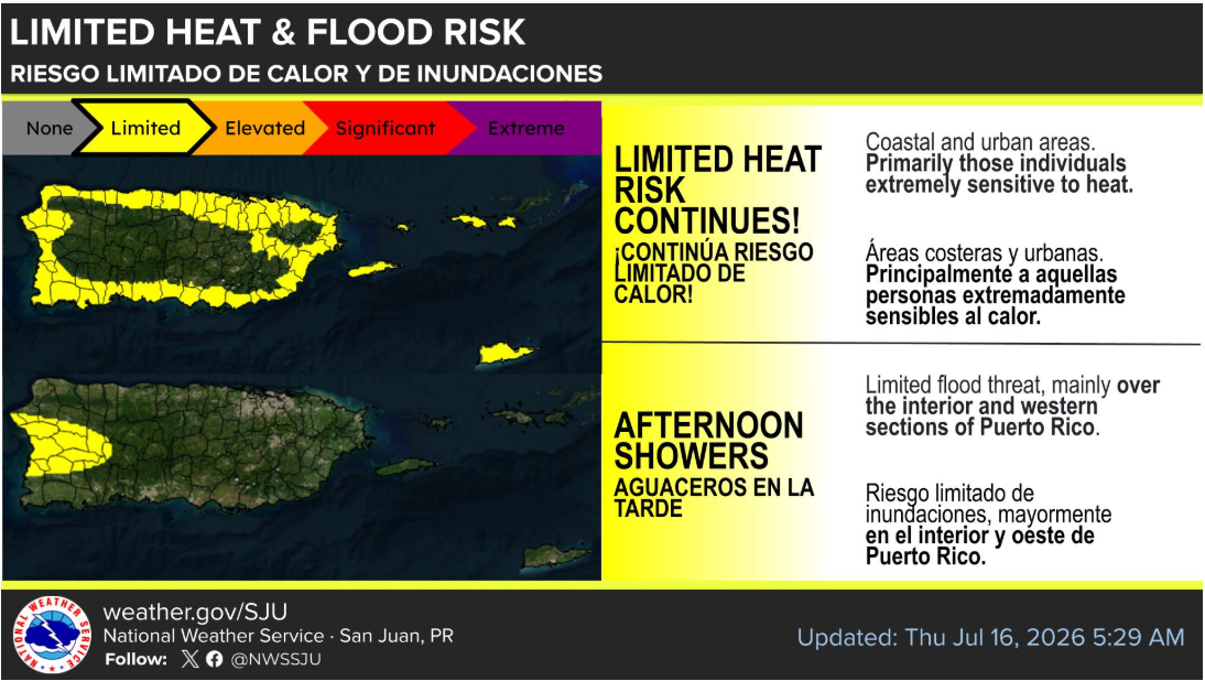
This means that while the actual air temperature might look mild on paper, the high humidity will push afternoon heat index values to a stifling 105 degrees Fahrenheit or higher. The increased moisture will also spark scattered afternoon showers and isolated thunderstorms across the region, though widespread flooding is not anticipated.
Enjoy the brief dip in dust while it lasts: another moderate-to-high concentration of Saharan dust is already forecast to roll into the territory by Sunday and persist into early next week.
(Facebook / NWS)
Even the Experts Have 'Sub-Par' Days
For local publishers and editors who occasionally stress over minor graphic glitches, today brought some comforting news: even the most well-funded federal agencies have their bad days.
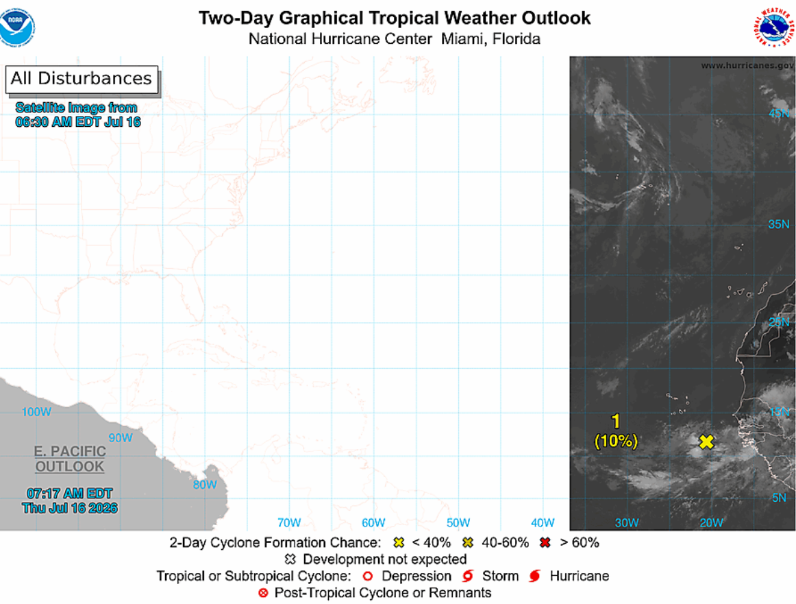
The National Hurricane Center's (NHC) official Two-Day Graphical Tropical Weather Outlook released this morning suffered a spectacular, system-wide rendering error.
Instead of displaying the standard satellite composite across the entire tropical Atlantic, the NHC's map template suffered a bizarre "split-screen" failure. The western two-thirds of the graphic—including the Caribbean and the eastern United States—rendered as a completely blank, stark white grid. Meanwhile, the actual satellite data was squeezed into a tiny, cropped strip on the far right edge of the screen, showing a minor tropical wave off the coast of Africa.
It looks like the meteorological computers in Miami might need a quick reboot. Until then, keep the eye drops close by, keep the AC running, and watch out for the flying asphalt dust on the West End!
(Facebook / NWS)
